
Snappit logo
Snappit
Get App
Generic illustration, not a photograph of this venueIllustration
ParkKR

Jirisan National Park

Jirisan is a mountain country of wooded valleys and long ridgelines.

About

Jirisan is a mountain country of wooded valleys and long ridgelines. Cheonwangbong rises to 1,915 m, while Nogodan’s 1,507 m summit offers a western introduction to the high country. A short-looking line on a map can still involve a full day on steep stone paths.

For a first visit, choose the broad approach from Seongsamjae, the streamside woods above Hwaeomsa, or Baemsagol’s pools and bridges. Experienced hikers can make Cheonwangbong the main event from Jungsanri or Baekmudong. Temples make a lower-valley day worthwhile even when the ridges are hidden. Pick your base and return transport before choosing how far to walk. Eager to name that creature? Identify any animal you find during your visit using the Snappit app.

Jirisan became Korea’s first national park on 29 December 1967. Its protection covers a whole mountain landscape across five municipalities, rather than a single summit or visitor entrance. Another important chapter began in 2004, when the national park service started restoring the Asian black bear population here.

What to do here

For mountain views without an eastern summit climb, consider Seongsamjae–Nogodan only after checking road access and the summit reservation. For a gentler introduction, turn back at Yeongiam above Hwaeomsa or Yoryongdae in Baemsagol. Ssanggyesa–Buril Falls adds a forest-and-waterfall option on the Hadong side.

Seasonal info

Spring brings yellow winter-hazel flowers in lower valleys before high slopes fully leaf out. Summer favours forest shade but also brings heavy-rain disruption beside streams. Autumn colour is a strong reason to choose Baemsagol; shorter daylight makes long summit routes less forgiving. Winter changes even Nogodan into an icy mountain outing.

Accessibility

Baemsagol has a specifically identified 1.1 km barrier-free section within the Banseon–Yoryongdae approach. This does not make the full 2 km route to Yoryongdae step-free. Nogodan has broad-path alternatives to some stone steps, but these still climb at altitude; neither summit route is presented as a wheelchair itinerary.

Don't miss

1

Nogodan’s open high-country views, with a separate summit reservation

2

Baemsagol’s named pools, bridges and lower-valley forest

3

Hwaeomsa and the quieter walk to Yeongiam

4

Cheonwangbong reached by demanding eastern mountain routes

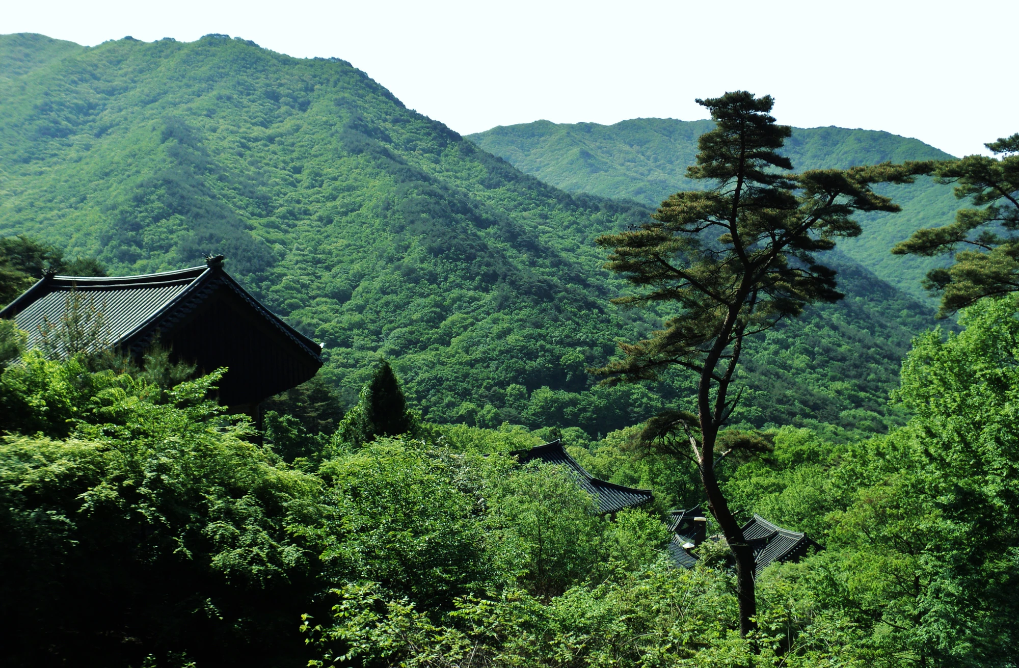
Dark tiled temple roofs and a tall pine-like tree stand before densely wooded green hills beneath a pale sky.

Temple roofs and wooded hills in a photograph titled “Jirisan,” taken on 16 May 2011 according to the photographer. The specific temple is not identified here; the image illustrates the mountain’s forest-and-temple setting.

“Jirisan” by Kyle (Kjmagnuson), Flickr, CC BY 2.0. Unchanged original; no crop, resizing or re-encoding. · Creative Commons

Walks and routes

Seongsamjae to Nogodan Pass and the reserved summit

Follow the established path from Seongsamjae via Munenggi and Nogodan shelter to Nogodan Pass. At the forks, the broad path takes longer than the stone-step shortcuts and is worth choosing if you want a less abrupt climb. The summit is a further, separately managed section: the booking page lists a 500 m direct one-way path, a 700 m bypass and an indicated 30 minutes. Leave time to enjoy the view and return to the same trailhead.

Broad earth, sand and gravel sections alternate with steeper choices. The summit approach is a mountain trail, and broad paths should not be read as a guarantee of step-free access.


Seongsamjae to Nogodan Pass and the reserved summit

Hwaeomsa to Yeongiam

The lower Hwaeom Valley path follows the stream through mixed earth and stone sections, crossing small bridges before the signed turn for Yeongiam. KNPS gives 2 km and about one hour each way; the same-path return is therefore about 4 km before temple wandering. Make Yeongiam your destination for a shorter day. The full Hwaeomsa–Munenggi course continues for 7 km one-way and about four hours, with a sharply steeper upper section near Kojae.

The lower walking path has uneven stones and bridges. A separate, mostly paved approach to Yeongiam also carries occasional vehicles; it is not verified here as a continuous accessible route.

Hwaeomsa to Yeongiam

Banseon to Yoryongdae in Baemsagol

Start at Banseon and follow the lower valley towards Yoryongdae. KNPS gives 2 km and about 40 minutes one-way, making a return of approximately 4 km. Continuing towards the pools of Byeongso, Byeongpungso and Ganjangso is a longer commitment. The full course to Hwagaejae is 9.2 km and four hours 20 minutes one-way, with a steeper upper stretch.

Only the specifically marked 1.1 km barrier-free section is described as suitable for wheelchairs. Confirm its current entrance, surface and facilities locally; do not assume the route beyond it has the same access.

Banseon to Yoryongdae in Baemsagol

Ssanggyesa to Buril Falls

From Ssanggyesa, follow the signed forest trail towards Buril Falls through Hwanhakdae and Buril Pyeongjeon. The official course is about 2.4 km each way, or 4.8 km and three hours return. Temple time and a slow waterfall stop come on top. This gives Hadong-based visitors a substantial woodland outing without committing to a major summit.

Expect high stone steps near the start, uneven forest tread and steep steps nearer the waterfall viewpoint. The final approach makes this unsuitable as a step-free walk.

Ssanggyesa to Buril Falls

Jungsanri to Cheonwangbong via Kalbawi

The established route climbs from Jungsanri via Kalbawi and Rotari shelter to Cheonwangbong, then returns the same way. KNPS gives 10.8 km and eight hours return. Beopgyesa beside Rotari adds a temple stop, but the high summit remains the main commitment. The final approach beyond Cheonwangsaem includes a steep stone staircase; reserve strength and daylight for descending it.

This is a demanding hike with rocky gradients, steps and sustained climbing. It is unsuitable for a casual stroll, a stroller or a wheelchair. The shortest prominent summit approach is still a strenuous mountain day.

Jungsanri to Cheonwangbong via Kalbawi

Baekmudong to Cheonwangbong via Jangteomok

The Hamyang approach climbs through forest from Baekmudong towards Jangteomok, then continues over the high ground by Jeseokbong to Cheonwangbong. KNPS gives 15 km and eleven hours for the return. The forest does not make the first climb easy: stone stairs and later rocky sections demand careful pacing. A properly reserved shelter night may divide the effort, but it needs its own route and weather plan.

Steep stone stairways start early. The descent places repeated strain on knees, so this route is a poor choice if steep downhill walking is already difficult.

Baekmudong to Cheonwangbong via Jangteomok

A straightforward Gurye half-day

Visit Hwaeomsa, walk to Yeongiam and return the same way. Add a temple stop and a meal around your transport connection; leave the strenuous upper Munenggi climb for another day.

Nogodan when the road and summit are available

Confirm the road approach and return journey, then secure summit entry. Walk from Seongsamjae by the broad path, pause at the pass and return after the summit with transport time in hand.

A northern valley day

Walk from Banseon towards Yoryongdae, enjoying water views from the trail before returning. If open, the visitor-centre exhibitions add context without extending the mountain walk.

Things to try

Temple and forest time

Pair Hwaeomsa with the lower valley, or Ssanggyesa with Buril Falls. Leave time to enjoy the temple setting and keep voices low around worshippers.

A shorter visit in unsettled weather

In light rain with paths open, a shorter temple visit or entrance-area exhibition may work. Hwaeomsa and Ssanggyesa still involve outdoor movement. In heavy rain, do not trade a closed ridge for a stream gorge; postpone the mountain walk.

Wildlife and habitats

Asian black bear

Jirisan’s restoration programme began in 2004. The bears are wild animals within a managed conservation landscape, not a sightseeing attraction. Stay on open trails, secure food and follow ranger instructions; never seek an encounter or use food to attract wildlife.

Fir (genus Abies)

Korean fir occurs on the high-elevation Jungsanri route and in Seseok’s wild forest. Here, firs are grouped at genus level. Keep to the established trail around these mountain woodlands; a closer photograph is not a reason to enter the undergrowth.

Pine (genus Pinus)

A 2012–2013 Seseok vegetation survey recorded Korean pine among the wild trees. Pines are grouped here at genus level. Their evergreen crowns contribute to the contrast with the seasonal foliage of broadleaf trees.

Stories and discoveries

Winter hazel belongs to the valleys

The park’s Korean winter hazel is a lower-slope shrub, not a summit speciality. KNPS identifies it in several valleys, including Baemsagol, and describes hanging yellow flowers appearing before the leaves in April. Actual flowering shifts with the season.

When to visit

High-ground autumn and winter checks

Check current fire restrictions before fixing a long autumn route. For winter Nogodan, check road ice and trail controls as well as the reservation. The operator specifically calls for traction when the summit trail is frozen.

Getting there and practical advice

Shelters and supplies

Book the correct overnight shelter and date through KNPS. A shelter bed does not replace reserved-trail entry, and a sales list does not guarantee supplies. Confirm your own meal and water arrangements.

Valley visitor information

Banseon’s Baemsagol visitor centre is a useful first stop for local path conditions, the barrier-free section and exhibitions. Check today’s opening before depending on an indoor visit.

Choose the gateway before booking your journey

For Hwaeomsa and the western side, the official bus guidance routes visitors through Gurye. For Baemsagol, it describes connections through Namwon or Inwol. For Jungsanri, it points to Wonji or Jinju, then the local Jungsanri stop. These are connection patterns, not a verified timetable: check the actual final service and the walk from the stop to the trailhead.

The autumn 2026 Seongsamjae road restriction

The closure covers the 1.4 km between Siamjae Rest Area and Seongsamjae Rest Area on county road 12. All vehicles are affected on weekdays from 12 October to 10 December 2026; the notice permits weekends and public holidays. Confirm any alternative approach with the operator or local road authority rather than letting navigation software choose an unverified detour.

Plan around a confirmed accessible section

Ask the Baemsagol office about the marked accessible section’s current surface, parking connection and toilets. Its published length does not settle those details. Arrange assistance around the confirmed section rather than the complete valley route.

Sources and useful links

Wildlife you might spot

3

Each card links to a full Explore page with photos, traits, and fun facts.

Snap map for this place

Start with the big picture, then zoom in to explore individual wildlife observations around this place.

Loading map…

Good to know before you go

For 12 October–10 December 2026, do not plan a weekday vehicle approach through the closed Siamjae–Seongsamjae road section. The notice allows weekends and public holidays; check for later changes before setting off.

Keep three checks separate

getting to the trailhead, permission to enter the reserved Nogodan summit trail, and a shelter bed if staying overnight.

At Baemsagol, decide your turnaround before continuing beyond Yoryongdae. The full route to Hwagaejae is a substantial one-way mountain walk.

Carry the water needed for your chosen eastern route. Chamsaem on the Baekmudong climb is listed as non-potable, and shelter shops can run out of bottled water.

At temples, keep voices low and leave worshippers room. Treat the temple visit as part of the day rather than a rushed checkpoint.

Use the current entry-cutoff and control pages for your exact route. A park-wide status badge does not settle road access, reservations or every trail section.

Frequently asked questions

Yes, the summit trail beyond Nogodan Pass has its own reservation. An overnight booking at Nogodan shelter does not replace it.
The Siamjae–Seongsamjae section is closed to all vehicles on weekdays from 12 October through 10 December 2026. The notice allows weekends and public holidays. Buses and taxis are also vehicles.
Choose Hwaeomsa–Yeongiam from Gurye or lower Baemsagol from the Namwon side. Both offer an early turnaround before the strenuous upper mountain sections.
No. The published Jungsanri return is 10.8 km and eight hours, with steep rocky ground. The descent is part of the effort; choose a valley walk if this exceeds your usual mountain day.
Do not plan around a sighting. The restored population ranges through wild habitat, and encounters cannot be promised. Enjoy the forest from open trails and follow park guidance.

Recent snaps at this place

Recent snaps will appear here as new observations are added.

View all ›

Take the discovery with you

Exploring Jirisan National Park?

Identify the wildlife you spot, learn as you go, and keep a collection of the adventure.

  1. 1Spot it
  2. 2Snap it
  3. 3Keep the discovery




