
Snappit logo
Snappit
Get App
Generic illustration, not a photograph of this venueIllustration
ParkKR

Gyeryongsan National Park

Gyeryongsan rewards choosing a manageable part of the mountain.

About

Gyeryongsan rewards choosing a manageable part of the mountain. Donghaksa offers the clearest first-visit progression: a gentler approach through the valley, a working Buddhist temple, then increasingly demanding ground toward the waterfall and ridge. Gapsa gives a different temple-and-forest day from the western side. Sutonggol, nearer Daejeon, belongs to the same national park but is a separate district; treat it as another outing rather than the next stop on a casual walk. Explore the grounds like a pro—download the Snappit app to instantly identify animals and plants.

Gyeryongsan became South Korea’s second national park on December 31, 1968, after Jirisan. Its cultural significance reaches much further back: KNPS describes its status as a sacred mountain in the Unified Silla and Joseon periods. Donghaksa, Gapsa and Sinwonsa are part of that long religious landscape. Visiting a temple here adds another scale to the day: mountain paths connect places of worship as well as viewpoints, and their grounds remain places to move through respectfully.

What to do here

Walk the Donghaksa valley to the temple, spending time along the wooded approach rather than rushing straight uphill. If you want a waterfall hike, continue only after checking the route and your remaining daylight. Stronger walkers can plan Gwaneumbong as the day’s main objective. Choose Gapsa for a shorter temple approach, or the Nammaetap route for a longer woodland walk with stone pagodas.

Seasonal info

Summer valley shade does not remove heat or storm risk, and wet stone is slippery. In winter, short daylight and icy steps can change a moderate-looking itinerary into a demanding one. Seasonal entry cutoffs and temporary controls apply even when the park’s main page reports normal operation.

Accessibility

For a less strenuous outing, concentrate on the lower temple approaches. KNPS describes the approach beyond Donghaksa’s Iljumun gate as generally level and paved, and the Gapsa parking-to-temple section as a gentler paved walk. These descriptions are not a verified step-free access audit. Do not extend that expectation to Eunseon Falls, Nammaetap or any summit trail.

Don't miss

1

Donghaksa’s wooded valley and temple approach

2

Eunseon Falls on a mountain trail above Donghaksa

3

Gapsa’s forest approach and temple grounds

4

Nammaetap’s paired stone pagodas, reached on a longer hike

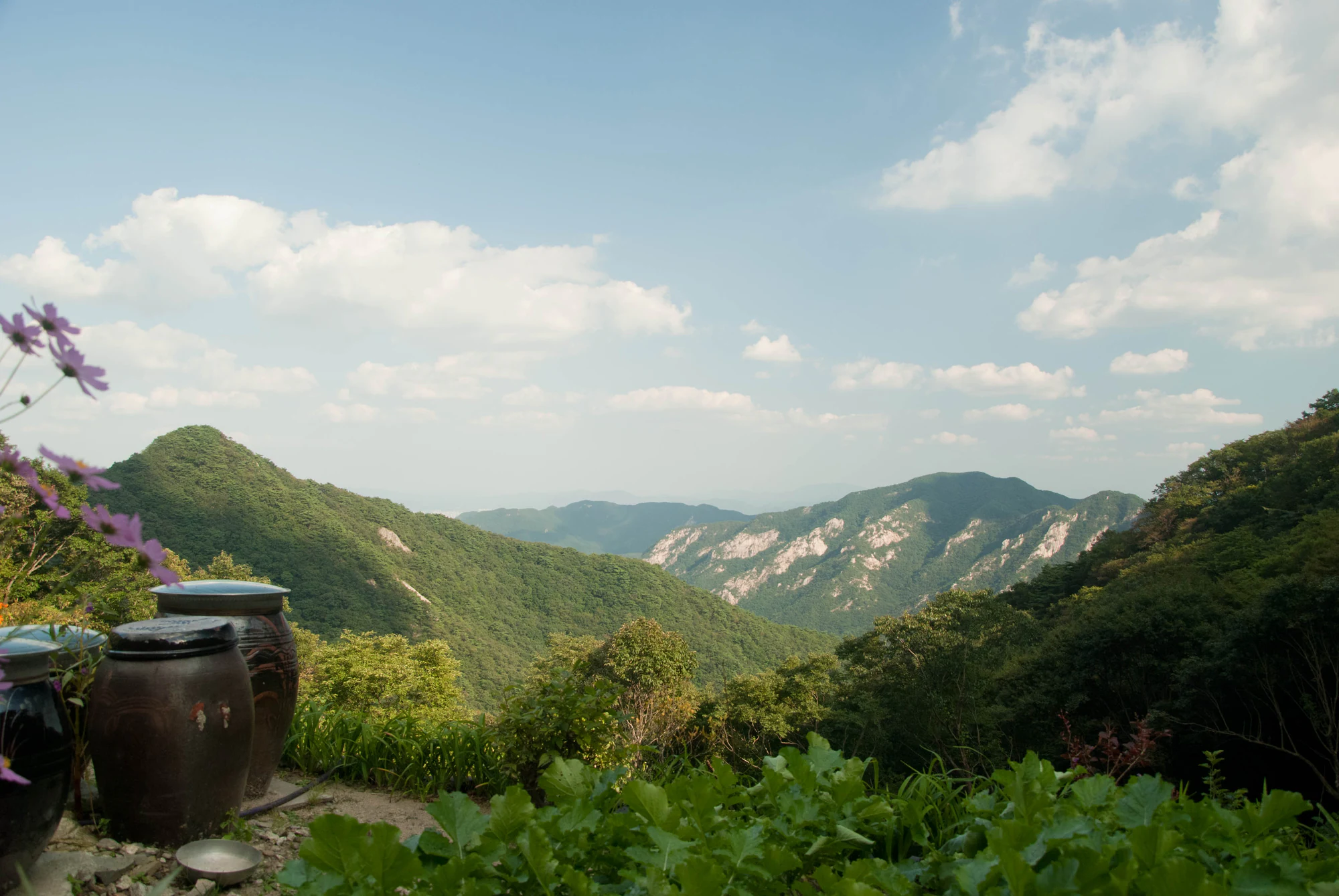
A forested valley and pale rocky ridges beneath a blue sky, with earthenware jars and flowers in the foreground.

Wooded slopes and rocky ridges at Gyeryongsan, photographed in September 2011.

“Gyeryongsan” (description: “A temple stay location.”), theaucitron, Flickr, photographed 22 September 2011. CC BY-SA 2.0. Unchanged. · Creative Commons

Walks and routes

Donghaksa to Eunseon Falls and Gwaneumbong

KNPS’s Donghaksa Course 1 runs from Donghaksa parking through the valley and temple to Eunseon Falls and Gwaneumbong: 4.4 km one way, with a published ascent estimate of 2 hours 30 minutes. The character changes beyond the temple and Hyangagyo Bridge. Stone steps become steeper around the waterfall and on the climb above it. For a waterfall outing, turn back after viewing the falls from the designated trail rather than automatically continuing toward the ridge. For Gwaneumbong, budget the descent separately and turn back if the rock is wet or time is running short.

Donghaksa to Eunseon Falls and Gwaneumbong

Gapsa: a short approach or a substantial ascent

The lower section from Gapsa parking to the temple is 0.9 km, with KNPS allowing about 30 minutes one way. The Orisup woodland approach makes this a satisfying destination without a summit. The complete Gapsa Course 1 continues through the valley and past Sinheungam toward Sambulbong: 3.8 km and 2 hours 30 minutes one way. The upper section becomes steeper; a temple visit and a Sambulbong hike should be planned as different levels of effort.

Gapsa: a short approach or a substantial ascent

Cheonjeong and Nammaetap: the longer woodland choice

The official Cheonjeong course links the support centre, Mungol junction, Keunbaejae and Nammaetap, then returns toward the visitor-centre area via Sejinjeong. KNPS lists 5.8 km and about 3 hours for the course. Much of the ascent is comparatively gentle, but the descent from Nammaetap has steep sections. Choose it when you want a purposeful mountain walk and time at the paired pagodas, rather than a level temple promenade.

Cheonjeong and Nammaetap: the longer woodland choice

Sutonggol: a separate Daejeon-side outing

Begin at the Sutonggol information centre for the reservoir and waterfall approach. The full Sutonggol Course 1 continues through Hwasan Valley to Geumsu Peak, 3.2 km and 2 hours 30 minutes one way. The valley’s upper stone steps are steep, so do not mistake the short distance for an easy stroll. A lower out-and-back is a more flexible choice when you are not prepared for the climb. Check Sutonggol-specific notices before travelling.

Sutonggol: a separate Daejeon-side outing

Save the long ridge circuit for a prepared hiking day

Donghaksa Course 2 is an 11.8 km circuit with a published estimate of 6 hours. It joins Donghaksa, Eunseon Falls, Yeoncheonbong, Gwaneumbong, Jayeonseongneung, Sambulbong and Nammaetap before returning to the parking area. The fortress-like Jayeonseongneung ridge includes steep, exposed rock; KNPS specifically cautions against taking young children or less steady walkers there. Add time for rests and treat bad weather as a reason to choose a lower route.

Save the long ridge circuit for a prepared hiking day

A relaxed first visit

Arrive at Donghaksa, read the day’s notices and walk the lower valley to the temple. Use your planned 2–3 hours for the approach, temple grounds and a comfortable return. If you still want more walking, decide before leaving the temple whether the waterfall trail fits your footwear, weather and remaining daylight. There is no need to add a ridge simply to complete the visit.

A hiking-focused day

Start early at Donghaksa with Gwaneumbong as your principal goal and a return plan that stays within current controls. Pause at the waterfall, reassess your pace before the steeper ascent, and leave a generous daylight margin for descending. Keep Gapsa and Sutonggol for another day instead of adding a second gateway after a tiring hike.

Things to try

Make the temple the destination

Slow down at Donghaksa or Gapsa to look at how buildings sit within the valley and wooded slopes. Stay outside active ceremonies unless visitors are welcomed, and let signs and temple staff guide where you can enter. A quiet temple visit pairs naturally with a short return walk.

Photograph the landscape without chasing a summit

The contrast between enclosed woodland and open rock is the park’s visual theme. On a short outing, work with the valley and temple approach. On a permitted ridge hike, stop only where the trail is wide and secure; do not step beyond barriers for a clearer view.

Shorten the plan rather than moving to another ridge

With light rain and no warning or closure, a brief lower temple approach may be enough. Avoid lingering beneath unstable slopes or beside swollen water. In heavy rain, thunderstorms or a closure, postpone the mountain visit. Switching from Donghaksa to Sutonggol does not by itself solve a regional weather problem.

Wildlife and habitats

The park’s flagship bird and flower

KNPS selects the ruddy kingfisher and Chinese twinleaf as Gyeryongsan’s flagship species. The kingfisher is a summer visitor associated with wooded valleys; Chinese twinleaf flowers in spring before its leaves fully develop. Their value here is as reminders of the habitat beyond the walking path. Keep your distance, never seek out nests, and leave flowers untouched. Neither is a promised sighting on this itinerary.

Five-leaf akebia

A 2018–2019 study documented five-leaf akebia in the temple forests of Donghaksa, Gapsa and Sinwonsa. These managed woods connect natural and cultural history; the study does not establish whether every individual plant was wild or planted.

Sawtooth oak

Sawtooth oak was recorded as a forest community in a 2001 study of Dongwol Valley. It adds context to the park’s varied woodland, rather than supplying a current spotting location along the Donghaksa route.

Stories and discoveries

A chicken and a dragon in the name

KNPS explains Gyeryongsan’s name through the traditional image of a dragon-like ridge carrying the crest of a chicken. Look up from the valley at the uneven skyline that inspired the comparison.

Paired pagodas in the woods

Nammaetap refers to the five-storey and seven-storey stone pagodas at the Cheongnyangsa temple site. KNPS dates them to the Goryeo period and notes their Baekje-style influence. They give the Cheonjeong walk a distinctive historical destination.

When to visit

Match the route to the season

In spring, keep flower viewing on the path. In summer, favour an early lower-valley visit when heat or thunderstorms threaten. Autumn suits temple woods, but fallen leaves can conceal slippery footing. In winter, shorten the objective if steps are icy and plan around the earlier entry cutoff; the descent deserves as much time and attention as the climb.

Getting there and practical advice

Use facilities before the climb

The Donghaksa route guide locates toilets beside Iljumun gate; the Gapsa guide identifies toilets before the temple, and Sutonggol has toilets near the entrance office. Use these lower facilities before committing to the upper trails. Carry your own water and supplies rather than assuming refreshments or toilets at a summit.

Getting to the Donghaksa start

For driving, use Donghaksa parking as your destination: 728-6 Hakbong-ri, Banpo-myeon, Gongju-si. KNPS’s bus directions route travellers via the Guam Station bus stop to bus 107 for Donghaksa. Confirm the current stop, departure and final return in a live journey planner; the published guide is not a live timetable. Changing to Gapsa or Sutonggol requires a new transport plan.

Check the exact portion you can use

If you use a wheelchair, mobility aid or stroller, ask the park about the specific lower approach, surfaces and toilet access before travelling. A generally level paved section may still have gradients, thresholds or temporary works. There is no verified continuous step-free route to Eunseon Falls, Nammaetap or the peaks in this guide.

Sources and useful links

Wildlife you might spot

2

Each card links to a full Explore page with photos, traits, and fun facts.

We are still adding species preview cards for this place.

Snap map for this place

Start with the big picture, then zoom in to explore individual wildlife observations around this place.

Loading map…

Good to know before you go

Pick your return route before setting off. A route’s published one-way time is only part of the day.

Carry water, a snack, a warm layer and rain protection; use footwear with good grip for stone steps.

Read the entrance noticeboard and ask staff about work zones and weather controls before entering.

Stay on designated trails. Leave plants, mushrooms and other forest material where they grow, and keep out of restricted valley areas.

Keep voices low around temple worship spaces and follow local photography signs.

Save the correct gateway and your return transport before leaving the entrance area.

Frequently asked questions

Yes. Make the lower approach and Donghaksa or Gapsa your destination. You can enjoy the setting without committing to the waterfall or ridge routes. Turn around at the temple if that is the outing you planned.
Do not plan an ordinary public hike to Cheonhwangbong. Gyeryong City identifies it as a military-protection area with restricted entry. Use designated public trails and permitted objectives such as Gwaneumbong, subject to current controls.
No. It is a separate district within Gyeryongsan National Park. Its trailheads and route choices are different from Donghaksa’s, so check which district your map, bus stop and weather warning concern.
No. A general status can coexist with construction, temporary helicopter operations or local restrictions. Read the dated notices and detailed trail-control page, then follow barriers and staff directions at the entrance.

Recent snaps at this place

Recent snaps will appear here as new observations are added.

View all ›

Take the discovery with you

Exploring Gyeryongsan National Park?

Identify the wildlife you spot, learn as you go, and keep a collection of the adventure.

  1. 1Spot it
  2. 2Snap it
  3. 3Keep the discovery
