
Snappit logo
Snappit
Get App
Generic illustration, not a photograph of this venueIllustration
ParkFR

Normandie-Maine Regional Nature Park and UNESCO Global Geopark

Normandie-Maine crosses the boundary between Normandy and the Pays de la Loire, taking in parts of Orne, Sarthe, Mayenne and Manche.

About

Normandie-Maine crosses the boundary between Normandy and the Pays de la Loire, taking in parts of Orne, Sarthe, Mayenne and Manche. This is lived-in countryside: villages, hedged fields, orchards and working forests surround the geological sites. Carrouges is a useful introduction, rather than a central gate through which every visitor must pass.

The UNESCO Global Geopark designation, awarded in 2024, recognizes a story stretching back some 600 million years. Ancient seas and two mountain-building episodes helped create rocks that now appear in ridges, gorges and village buildings. Boitron brings that large story down to a child-friendly scale: a short climb, interpretation panels and a hilltop looking towards the forests.

Choose one outdoor destination for your first visit. Boitron suits a group interested in landscapes and local history. The Écouves alternative asks a different question: how can the same forest provide timber, shelter wildlife and welcome walkers? Neither outing requires completing a grand circuit of the whole park. Be ready to snap and learn! Get the Snappit app to identify any nature species you find here.

Created in 1975 and reclassified in 2025, the regional nature park brings together landscapes that cross modern administrative boundaries. At Boitron, a medieval stronghold associated with Guillaume Ier de Bellême was followed by a windmill. Looking from its surviving tower makes that succession tangible: the same commanding hill could serve defence, milling and, now, landscape discovery.

What to do here

Orient yourself at the Maison du Parc et du Géoparc, then follow the Tour de la butte de Boitron from the village church. For a woodland-focused day, consider the ONF discovery loop from Carrefour du Rendez-vous in Écouves instead, after checking its access.

Seasonal info

Carrouges has a seasonal visitor timetable. Autumn and winter forest plans need a hunting-calendar check; summer heat can bring access restrictions. Boitron’s exposed summit is a poor choice in strong wind or a thunderstorm.

Accessibility

The Maison du Parc has documented adapted access. Boitron involves an uphill woodland path and steps to the mill viewpoint. Ask the operator about current path conditions before choosing either outdoor walk with a wheelchair, walking aid or pushchair.

Don't miss

1

A 1.3 km interpretation route around the butte de Boitron

2

An old windmill viewpoint above a sandstone outcrop

3

The forest’s working history and the value of dead wood

4

Carrouges’ interpretation centre and local landscape stories

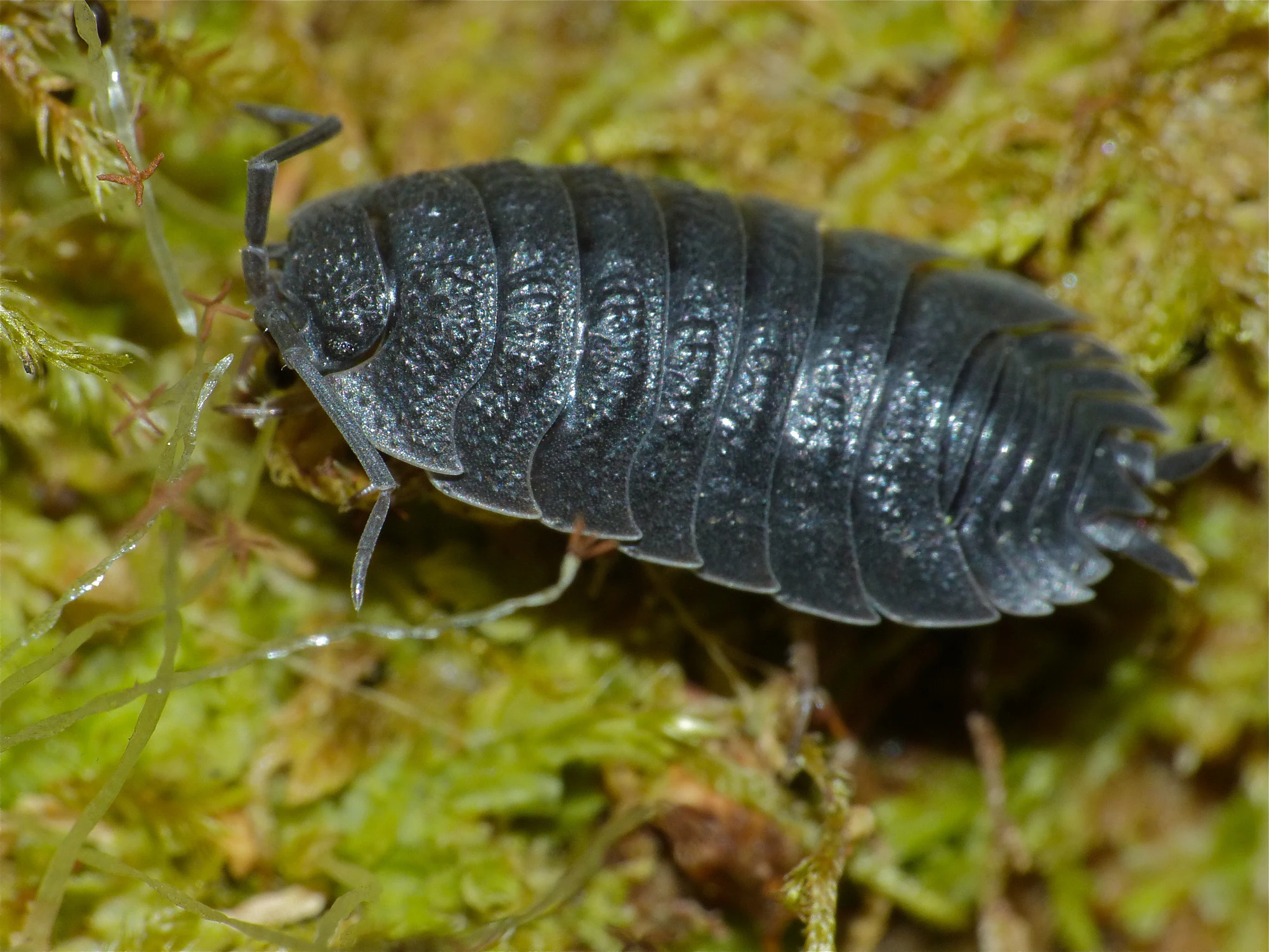
A dark grey woodlouse with segmented plates rests among green moss.

A woodlouse photographed in Écouves forest on 29 March 2014, identified by the photographer as Porcellio scaber.

Photograph: Bernard DUPONT, “Common Rough Woodlouse (Porcellio scaber)”, CC BY-SA 2.0. Original photograph unchanged. · Creative Commons

Walks and routes

Tour de la butte de Boitron

Begin at Boitron’s church and follow the equipped path through the wood to the hill and its interpretation panels. The park’s September 2026 inauguration notice gives the new discovery itinerary as 1.3 km. At the top, the surviving windmill tower offers a viewpoint; take its steps only if they suit your group. Allow 45–75 minutes for the walk, reading and view.

An uphill woodland outing, with a stepped mill viewpoint. A short distance does not make it level or suitable for every pushchair. Ask the tourist office about current surfaces, gradients and parking if anyone in your group needs a step-free route.

Boitron church, then the marked discovery path towards the butte.

Tour de la butte de Boitron

La gestion forestière : Écouves short discovery loop

Start at Carrefour du Rendez-vous and follow ONF’s signed circuit. The 2.1 km short version returns along the Route forestière de la Sente d’Essay after station 4; ONF also publishes a 2.5 km version. Its stated walking times are 45 minutes and one hour respectively. Allow 1–1½ hours for the short loop with children and interpretation stops. Download the ONF leaflet rather than improvising links between forest tracks.

Ask ONF about current surfaces and gradients before choosing this walk with a wheelchair or pushchair. A short woodland circuit can still be awkward after rain. Carrouges offers a more clearly documented adapted visit.

Carrefour du Rendez-vous, southern Écouves forest; Radon is the nearby gateway.

La gestion forestière : Écouves short discovery loop

A first half-day: Carrouges and Boitron

Start with the interpretation centre and choose what interests your group most: rocks, forests or the way people used both. After the transfer to Boitron, follow the discovery path at an unhurried pace and finish with the view if conditions suit. Keep a snack break flexible; complete one good outdoor visit rather than squeeze Écouves into the same half-day.

A forest-focused alternative

If ONF confirms the Écouves circuit and approach are open, make that your main outdoor stop. Read the forest-management panels, then use a picnic or café break to compare what you expected a forest to look like with what the walk revealed. If access cannot be confirmed, stay with the Carrouges visit and its clue hunt.

Things to try

Let the hill explain the map

At Boitron, use the panels and view together. Ask each person to pick out one wooded mass and one open area, then compare how they appear on the park map. The sandstone hill marks the meeting of the Armorican Massif and the Paris Basin; the pattern of relief is the beginning of the explanation, not just scenery.

Give dead wood a second look

On the Écouves interpretation walk, a fallen trunk has a role in the story alongside standing timber and young trees. From the path, look at its texture and any visible fungi or tiny animals. Photograph what is already exposed rather than rolling logs or peeling bark. The most interesting discovery may fit into a very small frame.

Try the Carrouges clue hunt

For children who prefer a mission, the park’s Quête Apprenti explores Carrouges and its heritage in under two hours. Pick up or print the Pass’Aventure, bring a pencil and a charged phone, and follow the official clues. It is a separate village activity, useful if you want to stay in Carrouges instead of transferring to another site.

Let the indoor visit carry the day

During published opening hours, Carrouges’ interpretation rooms provide a useful wet-weather visit. A light shower may simply shorten your outdoor plan; strong wind or a thunderstorm is a reason to skip the wooded circuit and exposed hill.

Wildlife and habitats

European beech

The park’s atlas records beech in the commune of Écouves. Use the woodland panels to connect the canopy above you with the next generation of trees below it. Looking for young trees is often more rewarding than expecting a large animal to appear.

Sessile oak

Sessile oak is also recorded in Écouves. This is a useful reason to look carefully at differences between neighbouring trees rather than call every broadleaf an oak. A field guide or the interpretation panels can help; leave leaves and acorns where they lie.

Black woodpecker

Recorded in Écouves, this woodpecker helps explain why dead wood matters: ants and other insects in wood are part of its food supply. Pause to listen from the path. Do not seek out occupied nest holes or play calls to draw birds closer.

Red deer

The deer on the park emblem has a living counterpart: red deer are recorded in Écouves. The rut generally falls around mid-September to early October, but it is not a guaranteed visitor spectacle. Choose an organized, confirmed outing if listening to the rut is your aim, and give animals plenty of space.

These species belong to the wider park and are documented around Écouves. The records do not promise sightings on either short walk, and the woodland species list should not be treated as an inventory of Boitron.

Stories and discoveries

Mountains worn down to countryside

The geopark’s rocks tell of two former mountain ranges and the development of the Paris Basin. Some of today’s quiet ridges are the eroded remains of a much larger geological drama. You do not need to collect a rock to follow it: the landform and the material used in buildings are clues in their own right.

A forest with a working past

Écouves’ charcoal once helped power local industry. ONF describes the forest as badly depleted by the middle of the nineteenth century, before a major replanting effort. Its apparent timelessness is misleading: management decisions and earlier livelihoods helped create the trees and spaces now enjoyed by walkers.

A chapter in Carrouges

The Maison du Parc occupies buildings with roots in the fifteenth-century religious complex beside the château. The park established its headquarters here in 1975. Today the public interpretation centre lets visitors connect built heritage with the surrounding landscape, without needing to treat the château itself as part of the same visit or ticket.

When to visit

Spring and summer

Use a clear spring day for Boitron’s panorama or a woodland visit when the leaves are fresh. In hot weather, take water and check fire restrictions before choosing forest shade as a refuge. Never light a fire or barbecue in the woods. A closure can override a route’s normal availability.

Autumn and winter

Autumn leaves add interest to a forest walk, but can conceal uneven or slippery ground. Check hunting zones and dates before going and read the signs again on arrival. In winter, build the day around short daylight and the actual Carrouges opening dates; do not assume the interpretation centre is open because its offices are occupied.

Getting there and practical advice

Maison du Parc et du Géoparc

The public visitor site is at 1 route du Château, Carrouges. Its published schedule is 2 April–31 October, daily 10:00–13:00 and 14:00–18:00, closed 1 May; a short reopening is listed for 7–18 December, 10:00–13:00 and 14:00–17:00. Self-guided visits are free. Picnic tables, toilets and hot drinks are listed. Confirm these dates before travelling, especially outside the main season.

At the outdoor stops

Bring what you need for the walk rather than counting on a café, drinking-water tap or toilet at the trailhead. Use village services before heading out, and ask about toilet access if it is essential for your group.

Separate the gateway from the trailhead

Carrouges, Boitron and the Écouves start are different destinations. Plan the transfer before leaving, using the exact start names. For Écouves, confirm the permitted approach and parking with ONF rather than relying on a through-route suggested by navigation software. Closed forest roads are not alternative walking approaches to assume open.

A public-transport option with limits

NOMAD line 404 links La Ferté-Macé and Alençon and serves Carrouges at Parking autocars du Collège. The current page specifies Monday–Friday in school term, excluding public holidays. Check both outward and return journeys for your date. Plan any onward journey to Boitron or the Écouves trailhead separately; line 404 is not advertised as a service to either start.

The best documented adapted visit

The Maison du Parc carries the Tourisme et Handicap label for motor, hearing, visual and intellectual accessibility. The operator lists reserved parking with an adapted path, a drop-off point, seats and a wheelchair available if needed. Ask ahead about any assistance or equipment you require. The outdoor walks have separate access conditions.

Sources and useful links

Wildlife you might spot

4

Each card links to a full Explore page with photos, traits, and fun facts.

Snap map for this place

Start with the big picture, then zoom in to explore individual wildlife observations around this place.

Loading map…

Good to know before you go

Save the official route page before travelling; follow the signs on the ground.

Wear shoes with grip, especially after rain or on fallen leaves.

Bring drinking water and a snack before leaving the village.

Keep children close on the hill and mill steps.

Leave stones, fungi, bark and dead wood where they are.

Keep a dog on a lead and check the rules for each site.

Park without blocking village entrances, forest gates or emergency access.

Use a different plan if a barrier or local closure affects your chosen outing.

Frequently asked questions

No. It is a large regional nature park and geopark containing settlements, farms, forests and individual visitor sites. Boitron’s discovery site and self-guided entry to the Maison du Parc are free. Other attractions and organized activities have their own arrangements.
Boitron is short, but its climb and mill steps still need close supervision. Choose Carrouges alone if an uphill path is unsuitable. The Écouves short loop is longer and should only be planned once its forest access is confirmed.
Check first. ONF notices still list restrictions on particular forest roads. A navigation app is not evidence that a gated road is open. Confirm the legal approach and parking for your exact destination before setting out.

Recent snaps at this place

Recent snaps will appear here as new observations are added.

View all ›

Take the discovery with you

Exploring Normandie-Maine Regional Nature Park and UNESCO Global Geopark?

Identify the wildlife you spot, learn as you go, and keep a collection of the adventure.

  1. 1Spot it
  2. 2Snap it
  3. 3Keep the discovery








