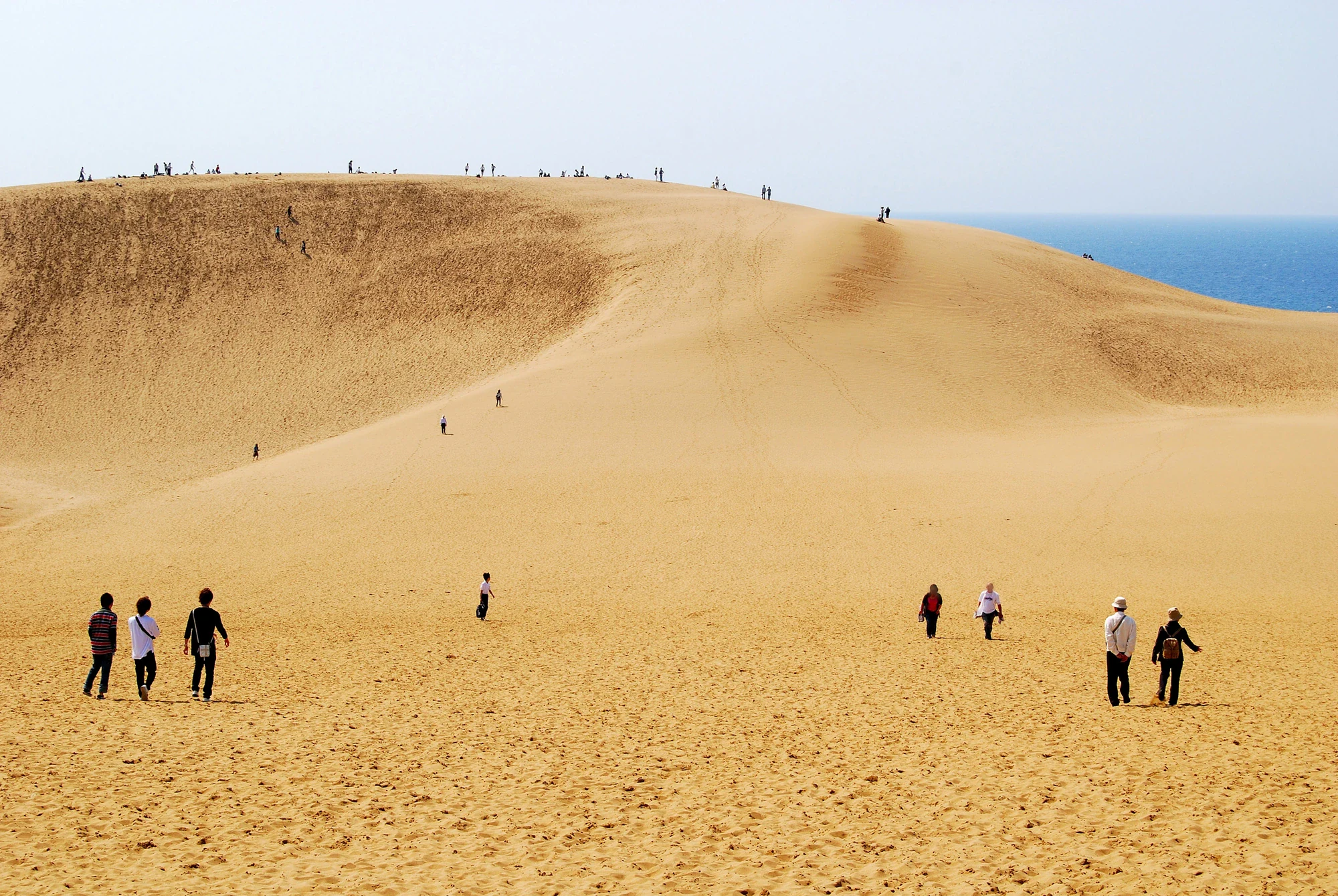
The big decision at Tottori Sand Dunes is how far you want to walk. You can enjoy the sweep of sand from the entrance-side viewing terrace, spend time with the visitor center’s hands-on exhibits, or cross the open dunes toward Umanose, the ridge known as the Horse’s Back. The climb gives you a wider view of the Sea of Japan, but soft sand makes every uphill step work harder than it would on a paved path. A good visit leaves enough energy for the return.
This is the western end of San’inkaigan National Park, a coastal park extending roughly 75 kilometers through Tottori, Hyogo and Kyoto prefectures. Elsewhere are rocky bays, sea caves, reefs and pine-topped islets. The dunes are a satisfying introduction, rather than a way to see the whole park in one afternoon. Uradome Coast and the more distant Hyogo and Kyoto sectors need their own travel plans. The larger San’in Kaigan Geopark is also a different designation, not an alternative name for the national-park boundary.
The landscape begins far inland. Weathered rock in the Chugoku Mountains supplies grains that rivers, especially the Sendai River, carry toward the sea. Waves return sand to the shore, and coastal winds move it inland. Look closely and the apparently simple surface becomes a record of that movement: parallel wind ripples, small protected sand columns, and delicate streaks left as sand slips down a slope. These patterns depend on recent wind and moisture. A smooth, footprint-covered or rain-darkened surface is part of the same living landscape.
Start indoors to give those shapes some meaning. The visitor center has a wind-ripple demonstration, microscopes for examining sand, tactile examples and displays about dune plants and insects. Its short dome-theater film shows how the scenery changes. Ask at the counter which features are visible today and pick up the local map. With children, choosing one question, such as why some plants creep along the ground, often makes the outdoor walk more interesting than simply racing to the highest ridge.
Umanose rises to about 47 meters above sea level; that figure is the ridge’s elevation, not the climb from the entrance. If conditions and your group’s energy allow, pause on top for the sea view before deciding whether to go any farther. The low area below sometimes holds the pool called the Oasis. Rain and snow feed its groundwater, so the pool expands and disappears with changing conditions; it is more typical from late autumn to spring and may dry out in summer. There is no need to reach the shoreline to complete this outing, and swimming off the dunes is prohibited.
The patches of vegetation deserve as much attention as the bare ridges. Sea bindweed spreads through underground stems and can produce pale pink flowers around late spring and early summer. Other local specialists include dune sedges and low-growing coastal shrubs. Open sand also supports small insects and their burrows. Keep feet clear of plants and respect ropes protecting habitat, even when the ground inside looks empty. Black-tailed gulls belong to the coastal scene, while barn swallows visit the dunes and nearby buildings in spring; sightings are always a bonus.
This open landscape takes care. Planting around the dunes helped protect settlements and farmland from blowing sand, but reducing sand movement also encouraged vegetation to spread into the open dunes. Conservation now balances those protective woods with work to retain the moving-sand habitat. That makes a useful final question for the day: when can keeping an area open be just as important as planting trees? Leave the plants and sand where they are, wash off your shoes at the visitor facilities, and take home photographs and new questions instead. Unlock an interactive field guide for this spot: get the Snappit app to identify nature on the go.
San’inkaigan became a national park on 15 July 1963, after an earlier quasi-national-park designation in 1955. Tottori Sand Dunes also received national Natural Monument protection in 1955 for their landforms and scientific interest. The dunes’ recent history includes sand-control planting, agriculture and later restoration of open sandy habitat. The present visitor center opened on 26 October 2018. Its displays connect the geology with the people who have lived beside, cultivated and conserved this coast.