Snappit logo
Snappit
Get App
Generic illustration, not a photograph of this venueIllustration
ParkCentre-Val de Loire / Bourgogne-Franche-Comté, FR

Loire Valley National Nature Reserve

The Loire here has more than one channel.

About

The Loire here has more than one channel. Water threads between wooded islands and exposed sediment, while quieter pools and former channels support another kind of life. The contrast is the attraction: you can think about a fast-changing river while standing in a sheltered patch of alluvial woodland. Les Saulières makes that landscape approachable without turning a first visit into a long hike.

The national reserve protects a 19 km stretch across Cher and Nièvre, shared by Centre-Val de Loire and Bourgogne-Franche-Comté. It is co-managed by the two regional nature conservancies. Herry is one gateway into this much larger protected reach; the short walk does not cover the whole reserve. The Loire-Anjou-Touraine Regional Nature Park and Saint-Mesmin National Nature Reserve are separate places farther along the river.

A useful question to carry on the walk is: what happens when the water moves? Floods erode one edge and leave sediment somewhere else. Young vegetation establishes on those deposits, while an abandoned channel may gradually fill with plants. The result is a mixture of open and wooded ground rather than a single uniform riverbank. You do not need to identify every bird or tree to enjoy it. Notice where the light changes, where the water seems still, and how different the land looks only a short distance away. Unlock an interactive field guide for this spot: get the Snappit app to identify nature on the go.

Les Saulières was used for motocross between 1981 and 1989. The conservancy bought land in 1994 and 1995 and rehabilitated a site once littered with tyres, wire and metal debris. The wider river reach became a national nature reserve on 21 November 1995. That history gives the woodland walk a second story: conservation here includes repairing past damage as well as protecting the river’s own work.

What to do here

Choose the Sentier des Saulières for a first visit. Read the entrance information, follow the maintained discovery path and pause where it gives a view of the secondary channel. Bring binoculars if you have them. A few good stops usually make a more satisfying visit than trying to cover extra ground.

Seasonal info

Nesting birds use the river’s exposed ground in spring and summer. The reserve leaflet identifies seasonal access restrictions at some nesting sites between April and September; the actual zones and dates are set by the relevant annual order and displayed on signs. Flooding can interrupt a walk in any season.

Accessibility

Saulières is a natural riverside path. Ask the reserve team about the surface, obstacles and approach before travelling with a wheelchair or pushchair, and plan for the possibility that only a shorter outing will suit your needs. Short distance alone does not establish an accessible route.

Don't miss

1

A 1.5 km discovery trail at Les Saulières, Herry

2

Alluvial woodland beside a secondary Loire channel

3

The changing relationship between sand, water and vegetation

4

A restored former motocross site with a new role for nature

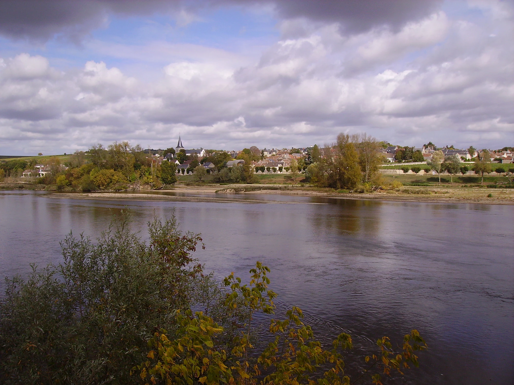
A broad river, sandy margin and tree-lined village beneath a cloudy sky.

The Loire beside Pouilly-sur-Loire in October 2009, with the village on the opposite bank. This historical photograph shows the wider river corridor, not the Saulières discovery trail.

“Pouilly-sur-Loire” — JPC24M, CC BY-SA 2.0. Source: https://www.flickr.com/photos/cjp24/5590109157/. License: https://creativecommons.org/licenses/by-sa/2.0/. Original photograph unchanged. · Creative Commons

Walks and routes

Sentier des Saulières, Herry

Start at the Saulières entrance information panel and use the currently maintained discovery path. The manager publishes a length of 1.5 km. Its woodland and secondary-channel setting suit a compact introduction to the Loire. Follow the on-site layout rather than adding an informal track towards the water; an older branch was taken out of use to protect a sensitive area.

Check the condition of the approach track and parking before travelling. For mobility needs, ask specifically about gradients, firm surfaces and obstacles along the path, as well as toilet arrangements nearby. Do not plan around a guaranteed step-free circuit.


Sentier des Saulières, Herry

An easy first visit

Set aside a morning or afternoon with no tight finish time. Read the entrance panel together, walk at the pace of the least confident person and choose two or three places to pause. Stop for a drink before everyone gets tired. If you want a longer day, add lunch in a nearby town or a separately timed Pavillon visit rather than extending the walk onto unfamiliar banks.

Things to try

A landscape sketch with children

At a comfortable stop on the path, divide a page into water, open ground and trees. Each person adds one thing they can see in each part. Then ask which parts might change after high water. This gives younger visitors something concrete to do without leaving the route or collecting plants.

Watch from one place

Choose a safe place with a view, settle your binoculars and give it a few minutes. Let birds come into the view rather than following them. If a bird repeatedly calls or changes its behaviour because of your presence, move away. A quiet stretch with few sightings can still reveal how the channel and woodland fit together.

Move the visit indoors

When the riverside walk is unsuitable, check whether the Pavillon’s exhibitions are open. For the 2026 Toussaint holidays, the operator’s detailed timetable lists daily opening from 17 October to 1 November, 10:00–12:30 and 14:00–17:30. Confirm before travel, especially around the end of the season. This is a separate destination, so include the transfer in your plan.

Wildlife and habitats

Eurasian Beaver

The Saulières leaflet describes beavers feeding on the woody growth beside a former channel. Look at the relationship between young trees and water; any animal encounter is a bonus. Leave waterside refuges alone and inspect only what is visible from the path.

Common Tern

Common terns are recorded in the reserve, where exposed sediment can become nesting ground. Watch from the permitted path or a distant legal viewpoint. A patch that seems empty to a person may contain eggs or young, so binoculars are much more useful than a closer approach.

Common Kingfisher

The reserve inventory includes the common kingfisher. Treat that as an invitation to watch patiently, not as a promised stop on the Saulières walk. Share the binoculars and keep a note of any bird you cannot confidently identify; there is no need to force a name onto every glimpse.

European Tree Frog

The European tree frog appears in the reserve inventory and the Saulières interpretation leaflet. The site’s pools help explain why a river reserve is also important to amphibians. Observe from the path without dipping nets, handling animals or stepping through pond-edge vegetation.

Stories and discoveries

The pools have more than one history

Some water-filled hollows at Saulières have a natural origin; others remain from past sand extraction. Their value now is as wetland habitat. A protected landscape can contain both the river’s history and traces of human use, with new life making use of both.

When to visit

Spring and summer

Bring binoculars for watching across the river landscape and give nesting areas generous space. Plan a modest outing in hot weather. A low river can expose more ground, but it does not make a shortcut through a channel or onto an island a sensible addition to the walk.

Autumn and winter

Favour a calm, clear day and leave time to finish in daylight. Read the flood forecast before travelling and take a change in conditions seriously. Strong wind is a reason to avoid woodland because branches can fall; a dry forecast does not remove the effects of earlier rain or high water.

Getting there and practical advice

A self-contained short outing

There is an information panel at the start and a free downloadable leaflet. Bring what you need rather than relying on trailhead toilets, drinking water, refreshments or staffed reception. For specific access questions, the reserve office can be reached on 03 86 60 78 25.

Pavillon du Milieu de Loire

For exhibitions and a different kind of family stop, consider the Pavillon du Milieu de Loire at 17 quai Jules Pabiot in Pouilly-sur-Loire. Exhibition entry is free during opening hours; bookable activities are separate. Its seasonal programme includes a permanent space about the reserve, temporary displays and children’s activities. Check the timetable before making the separate journey.

Approach from Herry

The conservancy’s directions start in Herry: take the RD 187, then the chemin rural des Sables, which crosses the Grande levée de Napoléon. Use the manager’s page to confirm this approach before travel. Stop at any vehicle restriction and keep access clear; do not drive farther along an unsigned track in search of river parking.

Arriving without a car

Herry’s mairie lists buses and reservation-based transport, and points to the stations at Pouilly-sur-Loire and La Charité-sur-Loire. Check the actual service for your travel date and arrange the final leg before committing to the trip. Neither station is the Saulières entrance, and the short trail distance does not include the journey from town.

Combining cycling and walking

The reserve management plan identifies access from the Loire à Vélo route on the levée. If you arrive by bicycle, check the current cycle itinerary and where you may leave the bike, then enjoy the discovery path on foot. Do not assume a bicycle parking facility or a continuously cycleable trail.

Plan for the person, not the distance

If uneven ground is difficult, ask the reserve team whether a short section is workable for your needs that day. Describe the chair, pushchair or walking aid you use and ask about the approach as well as the path. A planned indoor visit to the Pavillon may be a better option, but confirm its own access arrangements too.

Sources and useful links

Wildlife you might spot

4

Each card links to a full Explore page with photos, traits, and fun facts.

Snap map for this place

Start with the big picture, then zoom in to explore individual wildlife observations around this place.

Loading map…

Good to know before you go

Check the reserve’s advice and Vigicrues before leaving, then read the entrance notices. Choose another activity if the route is flooded, closed or unclear.

Bring walking shoes with grip, drinking water and sun protection; keep a warm or waterproof layer handy when the forecast is changeable.

Keep children beside an adult near water and well back from eroded banks. This outing stays on land, without swimming, wading or crossing to islands.

Pet dogs are not allowed in the reserve, even on a lead. Arrange a different walk if your dog is travelling with you.

Leave flowers, sand and stones where they are. Take photographs or notes rather than collecting things.

Carry out all litter. Fires, barbecues and overnight camping or bivouacking are not allowed.

Frequently asked questions

No. The commune publishes a longer Circuit de la réserve, listed as 6.5 km with an optional addition. This guide uses the conservancy’s short Saulières discovery trail. Check the name and length before choosing an itinerary.
Keep this visit to the maintained discovery path. Dry-looking ground is not evidence of public access or a safe crossing, and nesting restrictions may apply. Do not approach a colony for a better photograph.
The manager presents Saulières as a public discovery trail. Organised nature walks have their own arrangements: use the conservancy’s current event listing and follow its booking instructions. A guided visit can be a good choice if you want help interpreting what you see.
Picnicking is permitted under the reserve’s rules, but do not plan around tables or a café at Saulières. Choose an already open, permitted place away from the bank edge, avoid blocking the path and take everything away with you.
The site has documented beaver presence, but a short visit cannot promise an animal sighting. Enjoy the habitat and any signs visible from the path. Do not search waterside refuges or wait close to a suspected resting place.

Recent snaps at this place

Recent snaps will appear here as new observations are added.

View all ›

Take the discovery with you

Exploring Loire Valley National Nature Reserve?

Identify the wildlife you spot, learn as you go, and keep a collection of the adventure.

  1. 1Spot it
  2. 2Snap it
  3. 3Keep the discovery