Snappit logo
Snappit
Get App
Generic illustration, not a photograph of this venueIllustration
ParkKR

Daedunsan Provincial Park

Daedunsan packs a remarkably craggy skyline into a mountain usually listed at 878 metres.

About

Daedunsan packs a remarkably craggy skyline into a mountain usually listed at 878 metres. Pines break up the rock faces, wooded valleys cut into the slopes, and Macheondae draws walkers from several directions. The height alone is a poor guide to the effort: a short distance here can include a sustained climb, stone steps and an airy crossing.

For a first visit, choose one gateway and plan your return to it. The cable car belongs to the Wanju side; it does not serve the Surak Valley or Taegosa entrances. A summit crossing can leave you in another municipality with your car or return bus on the far side of the mountain. A shorter outing is perfectly worthwhile, provided you turn around before committing to terrain your group cannot comfortably negotiate. Explore the grounds like a pro—download the Snappit app to instantly identify animals and plants.

Daedunsan’s older name, Handeumsan, is associated with the idea of a great mass of rock. Its protection is split between separately designated provincial parks in Jeonbuk and Chungnam; the Chungnam designation dates to May 1980. The mountain is presented here as one travel destination, while its two legal parks remain distinct.

What to do here

Take a Wanju cable-car outing with an optional summit climb, spend a longer walking day on the Surak Valley circuit, or make Taegosa the main purpose of a Geumsan visit. Choose the bridges only if everyone is comfortable with height and steep steps.

Seasonal info

Spring flowers and autumn foliage change the character of the wooded approaches. Summer rain can make valleys hazardous; winter ice makes rock and metal steps difficult even when the cable car runs. Check the mountain forecast and local restrictions before setting off.

Accessibility

The summit routes are steep mountain walks. A cable-car ticket does not establish a step-free trip: both stations have several floors, and a continuous accessible route to boarding, toilets and viewpoints has not been verified. Ask the operator about your specific mobility needs before travelling.

Don't miss

1

Wanju’s rock bridges and views above the cable-car station

2

Macheondae summit, reached by several distinct approaches

3

Surak Valley’s waterfall scenery on the Nonsan side

4

Taegosa’s rock-framed entrance below Nakjodae

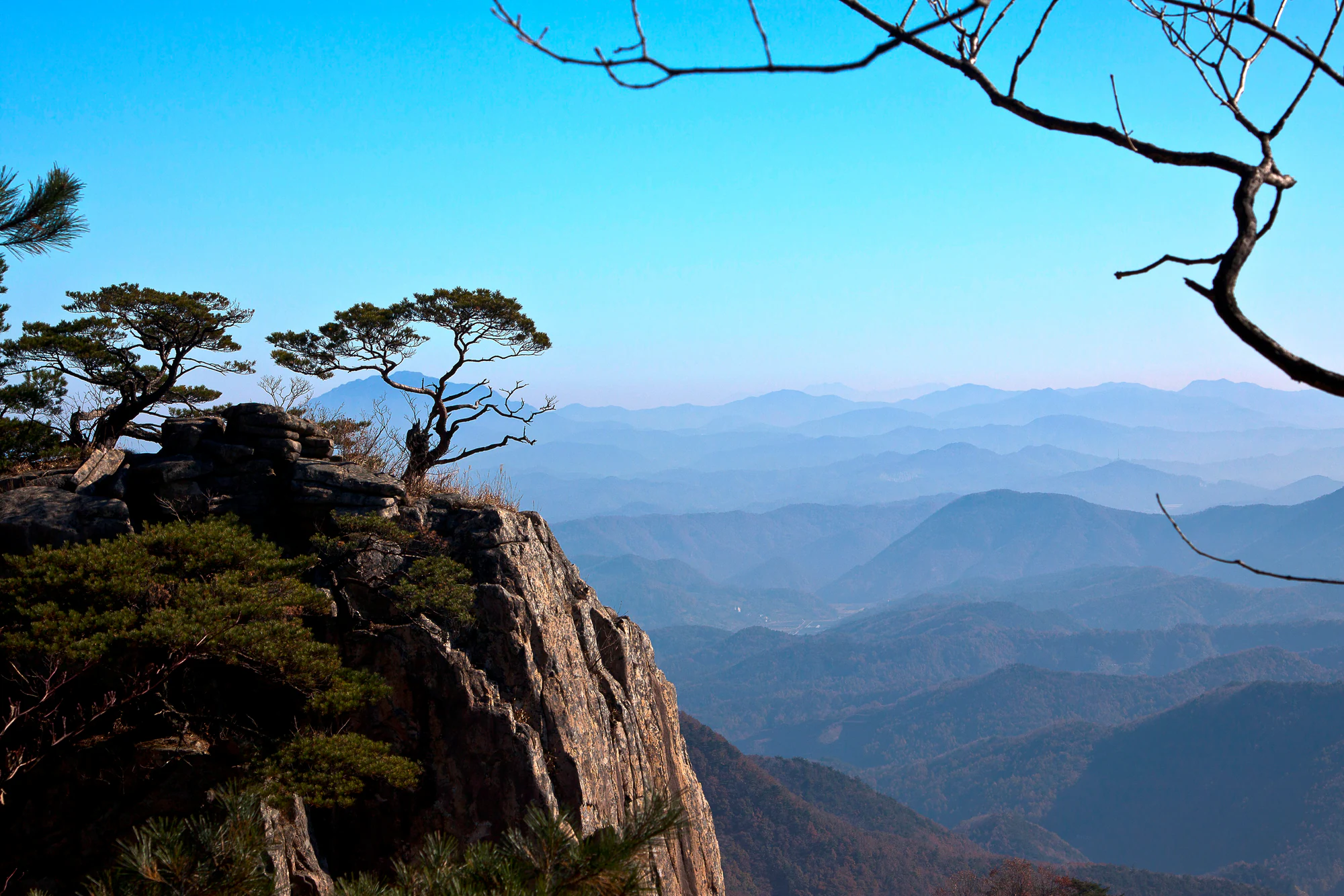
Pine trees grow above a rocky cliff on the left, while hazy blue mountain ridges recede into the distance beneath bare branches.

Pines, a cliff and layered ridges at Daedunsan in a photograph dated 3 November 2012 by its uploader. The exact viewpoint and park sector are unknown; this is a historical landscape view, not a guide to approaching the cliff.

Photo: [“대둔산”](https://www.flickr.com/photos/garipo/8207063669/in/photolist-dvem6K) by [barama1](https://www.flickr.com/photos/garipo/), [CC BY 2.0](https://creativecommons.org/licenses/by/2.0/deed.en). Original file unchanged. · Creative Commons 1 · Creative Commons 2

Walks and routes

Wanju: cable car, bridges and Macheondae

Start at the lower cable-car station, 55 Daedunsan-gongwon-gil, Wanju. The ride takes about five minutes; from the upper station, Wanju lists 0.8 km and approximately 40 minutes uphill via the bridge area to Macheondae. Treat that as the ascent alone. Look at the operator’s route diagram before leaving the station, choose the signed uphill option, and return by the descending trail to your boarding point.

Steep stone and metal steps remain above the cable car. The Samseon crossing is a steep stair bridge, and the Geumgang crossing is exposed. Neither is suitable for wheelchairs or strollers.


Wanju: cable car, bridges and Macheondae

Wanju: walk up from the car park

For a full uphill walk, the county’s first course runs from Daedunsan car park through Neusegol, Dongsim Rock and the cloud-bridge area to Macheondae. Its published 2.3 km and 1 hour 40 minutes describe the climb, not the whole outing. Check the county course table and map and identify the descending path before starting. Plan lunch and rest stops separately.

This is a sustained rocky climb, not an easy alternative to the cable car. Allow extra time for the slower members of the group and for a cautious descent.

Wanju: walk up from the car park

Nonsan: Surak waterfalls and a summit circuit

Nonsan publishes a 6.5 km circuit taking about 3 hours 30 minutes: the entrance ticket-office point, Seonnyeo Falls, Surak Falls, Macheondae, Nakjo Sanjang, Seokcheonam and back to the entrance. The city’s hiking page provides the sequence. This route makes the valley part of a substantial mountain day; the “ticket office” label is a wayfinding point, not evidence that admission is charged.

Expect uphill terrain and a demanding descent even though the day begins in a valley. Waterfall paths are not confirmed step-free; wet surfaces need particular care.

Nonsan: Surak waterfalls and a summit circuit

Geumsan: Taegosa first, Nakjodae only if planned

Make the temple your destination if you want a cultural visit rather than another summit climb. Geumsan describes a steep 2.6 km paved approach from the lower parking area by the volunteer fire brigade to the temple entrance. Limited parking nearer the temple may shorten the approach when permitted. For a separate substantial hike, Wanju lists Haengjeong car park → Taegosa plaza → Nakjodae → Macheondae as 5.64 km and about three hours uphill. These are different start-to-finish descriptions.

The road is steep and the temple approach includes a narrow passage between rocks. Do not assume that driving closer removes all walking barriers. A continuous step-free temple visit is unverified.

Geumsan: Taegosa first, Nakjodae only if planned

A flexible Wanju half-day

Arrive early enough to check the queue before committing to a summit plan. Ride up, assess the weather and your group’s comfort, then choose either a suitable station viewpoint or the mountain walk. Leave a generous margin for the descending trail and return ride. Add a meal after reaching the base rather than squeezing it between your last viewpoint and the last car.

A walking day from Surak

Start with the full loop and its return direction agreed, allowing around 5–6 hours with breaks. Walk the waterfall section without rushing, then reassess energy and conditions before continuing uphill. Return to the Nonsan entrance rather than following a convenient-looking descent toward Wanju. If time is short, choose the valley alone at the outset.

Things to try

Enjoy the bridges on your own terms

The Wanju suspension bridge is also labelled Wanju Daedunsan Cloud Bridge; its current structure was reinstalled in 2021. Farther up, Samseon turns the crossing into a steep climb. Decide whether the exposure suits you before joining a narrow section. If it does not, ask about the open alternatives or keep the visit to the station area.

Leave room for the valley

Surak Valley offers a different pace from Wanju’s cable-car gateway. Use a waterfall stop as a place to pause within your walking day, while keeping to the designated path. Treat the moving water as scenery rather than an invitation to enter the stream, especially after rain.

Visit Taegosa quietly

Taegosa sits below Nakjodae. Its Seokmun, or stone gateway, is a narrow opening between rocks associated with the scholar Song Si-yeol. The temple remains a place of practice: keep voices low, respect worship areas and ask before photographing ceremonies or people.

When the mountain plan is unsuitable

Do not treat Taegosa or Surak as automatic wet-weather substitutes: their access is also steep or waterside. If strong wind, heavy rain or ice makes the outing unsuitable, postpone the mountain section and spend the day in your arrival town. A station café is a rest stop, not a reason to ride up during a weather warning.

Wildlife and habitats

Pines

Evergreen pines are part of Daedunsan’s recorded vegetation. Their branching shapes stand out against the rock, particularly when nearby deciduous trees have lost their leaves. Enjoy the contrast from established paths without climbing out toward an isolated tree.

Oaks

Daedunsan supports several kinds of oak woodland. Their broad-leaved canopy makes the forested approaches feel very different from the exposed ridge. Look at the changing leaf shapes and woodland colours as you walk; several oak species can share a slope.

Azaleas and rhododendrons

Spring brings azaleas to the mountain. Flowering changes with elevation and weather, so treat blossoms as a possible bonus. View plants from the path and leave flowers undisturbed.

Stories and discoveries

A mountain shaped by names

Dongsim Rock has a story that the monk Wonhyo stayed beneath it for three days, captivated by its form. Read this as a local legend attached to a distinctive rock, not a geological date or a documented account of the visit.

A wooded mountain, as well as a rocky one

A botanical study based on nine visits in 2016–2017 recorded 434 vascular-plant taxa around Daedunsan. That historical survey gives a sense of the mountain’s variety; it is not a count of what you will see on one trail today.

When to visit

Spring and autumn

In spring, expect flowering shrubs and changeable temperatures. In autumn, foliage draws more visitors and makes early arrival worthwhile. Let the current forecast, open route and daylight determine the plan rather than chasing a fixed flowering or colour date.

Summer and winter

In prolonged rain, skip the valley and exposed ridge rather than moving to another entrance in search of an open path. In winter, shaded steps and bridge decks can stay icy. Follow seasonal fire restrictions and weather closures even when a general tourism page describes year-round visiting.

Getting there and practical advice

Cable-car tickets and hours

The operator currently lists adult tickets at KRW 16,500 return or KRW 13,500 one-way, with general hours of 09:00–17:50 and ticket sales ending 20 minutes before closing. Tickets are sold on the day, in sequence, with no advance reservation. Strong wind or lightning can stop service early. Confirm the last return departure when buying your ticket.

The 2026 autumn first departures

The autumn notice gives an 08:00 start on 17–18 and 24–25 October, 31 October–1 November, and 7–8 and 14–15 November. Starts are 08:40 on 26–30 October and 2–6 November, and 09:00 on 19–23 October, 9–13 November and 16–20 November. These are first departures only; do not assume a later closing time.

Toilets, breaks and parking

The operator lists toilets, waiting/rest areas and shops across its station floors. Use facilities before heading onto the trails and carry your own water. Wanju’s tourism page lists park admission and parking as free; Nonsan lists free admission but KRW 2,000 for a passenger car at Surak. Check local signs, because the two gateways have different arrangements.

Taegosa visiting hours

Geumsan lists free temple entry, summer visiting hours of 09:00–18:00 and winter hours of 09:00–17:00. Confirm the applicable season and vehicle access with the temple on 041-752-4735. The small parking area near the entrance is not a guarantee of a space.

Getting to the correct base

For the cable car, use 55 Daedunsan-gongwon-gil, Unju-myeon, Wanju-gun. For Surak, choose the Nonsan entrance on Surakgyegok-gil in Beolgok-myeon. For Taegosa, use 440 Cheongnimdong-ro, Jinsan-myeon, Geumsan-gun. Check the exact drop-off and return pickup with your driver before leaving town.

Bus connections need a return plan

The cable-car access page says Daejeon bus 34 reaches the natural recreation forest/Baetijae area, not the Wanju park entrance, and describes a connection with Wanju bus 300. Nonsan’s hiking page lists bus 304 from Nonsan Station for Surak. These are planning leads, not verified departure times: confirm the current route, connection and last return before travel. Do not rely on walking an unfamiliar roadside transfer.

Ask about the entire cable-car visit

Before travelling with a wheelchair or walking aid, call 063-263-6621 and ask about parking-to-ticket-office access, lifts between station floors, boarding thresholds, accessible toilets and the viewpoint you want to use. The published floor list alone does not verify any of those connections. Choose a visit everyone can complete without having to be carried.

Children, height and fatigue

Keep children close on narrow crossings and stop before tired legs make the descent unsafe. A bridge visit involves both exposure and managing other walkers. For anyone uneasy with heights, agree on a shorter objective before buying tickets; changing plans at the base is easier than doing so midway along a stair bridge.

Visitor information

Before you travel: Chungnam announced that all of its Daedunsan designated trails reopened at 11:00 on 2 September 2026. Wanju’s park page and the cable-car homepage showed normal status when checked on 18 October UTC; the cable-car page displayed 19 October in Korea. These are dated checks, not a promise for your visit. Recheck Chungnam notices and the Wanju park page for the side you will use.

Sources and useful links

Wildlife you might spot

3

Each card links to a full Explore page with photos, traits, and fun facts.

Snap map for this place

Start with the big picture, then zoom in to explore individual wildlife observations around this place.

Loading map…

Good to know before you go

Save the Korean name of your exact entrance, not just 대둔산, before arranging a taxi or setting navigation.

Wear shoes with a secure grip and carry water, a warm layer and rain protection even for a cable-car-assisted climb.

Set a turnaround time that protects the descent, last cable car and return transport. A summit arrival time is only halfway through the plan.

Keep narrow stairways clear for moving walkers. Stop for photographs only where you can stand safely without blocking the path.

Stay on designated open paths and respect barriers. An attractive rock ledge in a photograph is not a visitor viewpoint.

Frequently asked questions

No. It ends at an upper station on the Wanju side. Wanju’s course table lists another 0.8 km and about 40 minutes uphill to Macheondae; the return walk, stops and queues are additional.
The operator’s route diagram makes the Geumgang and Samseon crossings uphill-only. Use the signed descending trail instead, and confirm the open bypasses before setting out.
You can make the cable-car ride and a suitable open station viewpoint the purpose of your visit. Ask staff which areas you can reach comfortably; do not assume that a bridge bypass is easy, step-free or open.
They lead into the same mountain but start on different sides. Wanju’s cable car, Nonsan’s Surak Valley and Geumsan’s Taegosa need separate road or bus plans. Arrange a pickup in advance if you intend to finish elsewhere.

Recent snaps at this place

Recent snaps will appear here as new observations are added.

View all ›

Take the discovery with you

Exploring Daedunsan Provincial Park?

Identify the wildlife you spot, learn as you go, and keep a collection of the adventure.

  1. 1Spot it
  2. 2Snap it
  3. 3Keep the discovery