
Snappit logo
Snappit
Get App
Generic illustration, not a photograph of this venueIllustration
ParkBR

Pico Paraná State Park

Between Campina Grande do Sul and Antonina, the park protects part of the Serra do Ibitiraquire within Paraná’s Serra do Mar.

About

Between Campina Grande do Sul and Antonina, the park protects part of the Serra do Ibitiraquire within Paraná’s Serra do Mar. Its namesake reaches about 1,877 metres above sea level. That figure describes the summit’s altitude, not the amount you climb from the trailhead. The experience is far bigger than a number: the surrounding ridges make a strong impression even when the highest summit is not your objective.

The forest does not simply end at a scenic overlook. Vegetation changes with elevation, becoming lower before giving way to the herbaceous and shrubby formations known as campos de altitude. Look closely from the established path: the low vegetation is a living mountain habitat, not spare ground for a shortcut or an extra tent. A photograph of bare-looking summit country can disguise how easily its soil is damaged.

Plan three separate things: getting to an authorized access, complying with park registration, and completing a mountain route safely. A private farm’s parking or accommodation service is not the park administration, and paying a private business does not replace official check-in. Equally, a staffed base does not make the distant mountain a supervised attraction. Bring the experience, equipment and judgment appropriate to the route you actually intend to walk. Explore the grounds like a pro—download the Snappit app to instantly identify animals and plants.

What to do here

Make one mountain the focus of the day. Itapiroca, Camapuã and Tucum offer alternatives to the namesake summit, but none should be selected only because a photograph looks inviting. Compare the official route figures, discuss the party’s experience with staff, and resist adding another summit just because a junction makes it appear close.

Seasonal info

A sunny approach does not promise a sunny summit. Fog, strong wind and abrupt cooling can change both navigation and comfort. Choose flexible travel arrangements where possible, so postponing for weather does not feel like losing the whole holiday.

Accessibility

These are mountain paths, not a paved summit promenade. Route distance alone says little about balance, exposure or the ability to reverse an awkward section. Visitors needing step-free access should establish what is possible at the approach and base before travelling.

Don't miss

1

The contrast between Atlantic Forest and high-altitude grasslands.

2

Views across the Ibitiraquire mountain landscape when visibility allows.

3

Several distinct summit objectives rather than one compulsory itinerary.

4

A close look at conservation in action around recovering summit vegetation.

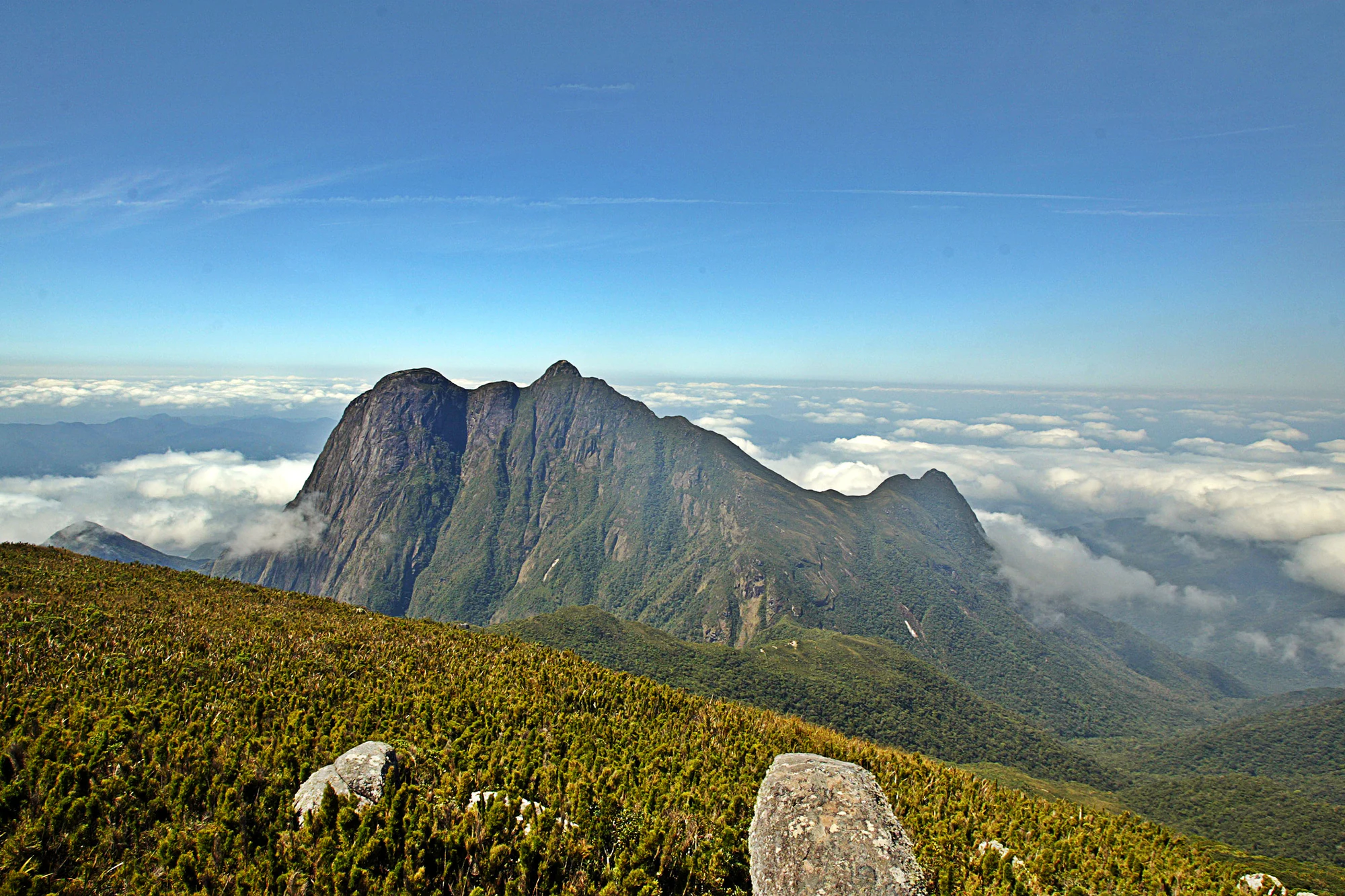
A rugged, green-sided mountain ridge rises above banks of white cloud, with low vegetation and pale rocks in the foreground.

Mountain landscape in Pico Paraná State Park. Archival photograph; capture date unverified.

Denis Ferreira Netto/SEDEST · Creative Commons

Walks and routes

Pico Paraná: the demanding objective

IAT’s Caratuva-sector board lists 15.2 km and 13 hours round trip, with high physical effort and very high serious-accident risk. Treat this as serious mountain terrain, not an ordinary fitness walk. Ask specifically about exposed and fixed-aid sections and whether everyone can descend them confidently. A short distance on a map can consume considerable time.


Itapiroca: choose a shorter mountain day

The same board gives 10.2 km and 6 hours 40 minutes round trip for Itapiroca, with moderate physical effort. It remains a substantial outing rather than an introductory stroll. Ask which summit areas are available: roped restoration patches must be left alone. Getúlio is a shorter listed alternative at 6 km and 3 hours round trip.

Camapuã or Tucum: a separate approach

The Camapuã-sector board starts at Chácara da Bolinha and lists Camapuã at 7.5 km and 5 hours round trip, or Tucum at 9.3 km and 6 hours 30 minutes. Both have moderate physical-effort ratings. Choose one objective with the base or guide; do not add the two distances together as if they were independent loops.

Things to try

Notice the forest before chasing the skyline

Pause at a safe place on the path and compare the shapes of fern fronds, climbing plants and bromeliads. Listen without playing recorded calls or using a speaker. You do not need to identify every plant to appreciate how different the sheltered forest feels from the open upper slopes.

Make a family outing about observation, not conquest

For mountain-experienced families, agree on a deliberately modest objective with local advice. Let younger walkers notice changes in leaves, cloud and wind, and make turning around an expected option. For children new to hiking, first build confidence on genuinely easier trails elsewhere rather than choosing Pico Paraná as a test of endurance.

Photograph the mountain without enlarging the trail

Choose a stable stopping place already on the permitted route, then put the camera away before moving over awkward ground. Keep compositions within the access you have, instead of stepping through vegetation for a cleaner foreground. Cloud can be part of the landscape; waiting for it to clear is optional, returning safely is not.

Wildlife and habitats

State accounts list jaguars, cougars and ocelots among the park’s native fauna. This is conservation context, not a promise of an encounter or a current sighting report. Enjoy any wildlife from a distance and leave it undisturbed; never leave the trail to search for an animal.

Stories and discoveries

A young park protecting an old landscape

The state park was created on 5 June 2002. Its protected mountain setting belongs to the Serra do Mar, while Ibitiraquire names the more specific range here, not another park to add to an itinerary.

The low plants protect a deep story

The high-altitude soils accumulated organic material over thousands of years. They retain water and carbon, so avoiding trampling protects more than the visible plants. Their importance is not proportional to the height of their vegetation.

Restoration is part of today’s visitor experience

IAT began roping off degraded patches at Caratuva and Itapiroca in June 2026, without a fixed reopening date. An October update reported further signs and camping restrictions. A clearing that looks usable may be deliberately resting, not waiting for another tent.

Getting there and practical advice

Ask private access providers about parking, toilets, accommodation and opening arrangements. Those services are distinct from facilities on the mountain. Do not rely on the names Abrigo 1 or Abrigo 2 as promises of staffed refuges, beds, meals or drinking water.

No verified continuous step-free mountain route is presented here. Uneven surfaces, sustained ascent and more technical terrain can make assistance needs very different from those on a city park path. A shorter summit option is not automatically suitable for a wheelchair, stroller or visitor with limited balance.

Sources and useful links

Wildlife you might spot

3

Each card links to a full Explore page with photos, traits, and fun facts.

Snap map for this place

Start with the big picture, then zoom in to explore individual wildlife observations around this place.

Loading map…

Good to know before you go

Before leaving your accommodation, agree on the chosen route, a turnaround time and a return plan. Tell a trusted person where you are going. Keep the group together, especially when one member is slower; arriving at a summit separately is not a successful group outing.

Carry waterproof layers, warm clothing, dependable footwear, water, food, a headlamp with backup power, a whistle and first-aid supplies. Save appropriate maps offline, but do not treat a downloaded track as permission to bypass a barrier or as proof that you can navigate in fog.

Plan the descent while everyone is still fresh. If the pace is already slower than expected, shorten the objective early. A tired person must still negotiate the same terrain on the way back; an attractive summit photograph is not a reason to spend the reserve needed for returning.

Frequently asked questions

Park entry is free. Private properties at the approaches may charge for parking, bathrooms, overnight use or other services. Ask the chosen provider for its current price and what it includes; no private fee is quoted here.
Yes. Use an authorized IAT base, complete the required visitor registration and risk paperwork, and record your return. Check the current pre-registration procedure before departure. An informal trail from adjacent land is not an acceptable substitute, even if someone offers access.
Do not assume so. The IAT page contains conflicting instructions: one banner says booking is not yet required, while dated provisions require advance overnight reservations from 23 May 2026. Confirm the live procedure and an authorized clearing directly with the park before committing to an overnight trip.
The park does not impose a universal guide requirement. For a first visit or limited mountain experience, arrange competent local guidance. Ask about the exact itinerary, technical sections, group size, equipment and turnaround policy, not just whether the provider promises the summit.
No. Published 24-hour base attendance is not unrestricted trail access. The rules prohibit visitation in rain, with reopening after 24 hours without precipitation. Restoration barriers and other closures still apply; confirm the situation for your sector and day.
Minors need a responsible adult and the risk form. Treat family suitability as a separate decision, not as implied by permission to enter. Pets are prohibited; ask the park in advance about legally protected assistance-animal exceptions and the practical terrain limitations.

Recent snaps at this place

Recent snaps will appear here as new observations are added.

View all ›

Take the discovery with you

Exploring Pico Paraná State Park?

Identify the wildlife you spot, learn as you go, and keep a collection of the adventure.

  1. 1Spot it
  2. 2Snap it
  3. 3Keep the discovery







