Snappit logo
Snappit
Get App
Generic illustration, not a photograph of this venueIllustration
ParkAuvergne-Rhône-Alpes, FR

Pilat Regional Nature Park

The Pilat sits between the Saint-Étienne area and the Rhône valley, where an inhabited, working mountain landscape changes markedly with altitude and exposure.

About

The Pilat sits between the Saint-Étienne area and the Rhône valley, where an inhabited, working mountain landscape changes markedly with altitude and exposure. On the Haut-Pilat plateau, pastures, granite farm buildings and woods give the countryside its shape. Water is part of the story everywhere: in wet ground, streams, reservoirs and the industrial heritage of mills and sawmills. It is a useful place to show children that a protected landscape can also be someone's home and workplace.

Gimel is a particularly manageable introduction. Near the sources of the Dunerette, around 1,200 metres above sea level, its peatland began forming more than 8,000 years ago. A drain cut in 1986 disturbed the wetland; later conservation work has included restoring its hydrology. The interest is in the small details beside the walkway rather than a distant summit view. Look for changes between wooded margins and open, wet vegetation, then use the panels to understand why keeping water here matters.

The wider park contains very different habitats, from upland heath and beech–fir woodland to warmer Rhône-side slopes. Gimel belongs to the scattered Tourbières du Pilat et Landes de Chaussitre Natura 2000 site. Its protected wetland is a place to observe from the built route, not a patch of open ground to explore on foot. A successful visit can be short: one carefully noticed plant, an insect above the vegetation and a clearer idea of how a bog works are plenty. Unlock an interactive field guide for this spot: get the Snappit app to identify nature on the go.

The Pilat received regional nature park status in 1974. At Gimel, conservation is more than drawing a boundary around a pretty landscape: a change to drainage can alter the conditions that allow a peatland to survive. The park's Natura 2000 work describes blocking an old drain to help restore the water regime. The walkway gives visitors a way to learn about that work without adding trampling pressure to the habitat.

What to do here

Start at the Tourbière de Gimel parking area in Saint-Régis-du-Coin and follow the interpretation walkway and its on-site plan. Make the panels part of the walk rather than something to read at the end. Give each child one question to investigate: where is the water, which plants grow nearest it, or why would scientists measure this place? Leave measuring equipment alone and keep feet, wheels and picnic gear on the visitor surfaces.

Seasonal info

The visitor listing advertises year-round access, but snow, ice, storm damage or work on the walkway can change the practical situation. In autumn and winter, check local hunting notices as well as the forecast. Treat a barrier or closure sign as the end of the outing; do not bypass it through the bog.

Accessibility

Gimel is described by the tourist office as wheelchair-accessible with assistance. That wording matters: do not assume independent access or a completely level surface. Ask about the current parking-to-walkway connection, board condition and turning space before a wheelchair or pushchair visit.

Don't miss

1

A short interpretation walkway through a high-altitude peatland

2

The tiny round-leaved sundew, a carnivorous plant of the bog

3

Water, forestry and farming in one very readable upland landscape

4

A family visit that does not depend on reaching a rocky crêt

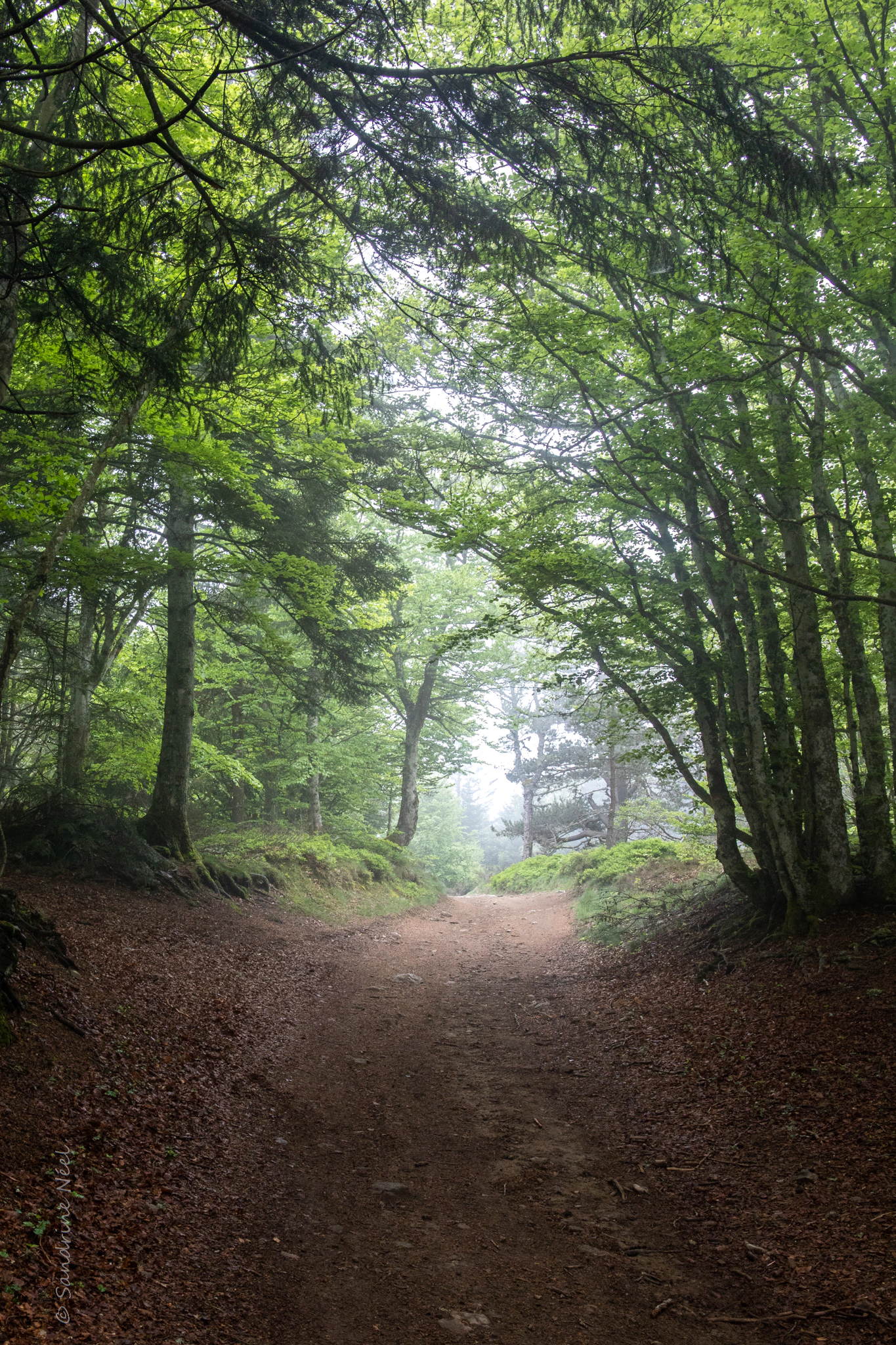
A broad dirt path runs beneath green branches towards pale mist, with leaf litter along its edges and the photographer’s signature visible at lower left.

Woodland in the Pilat massif, photographed on 6 June 2021. The source does not identify the path; the photograph does not show the Gimel boardwalk.

“Le massif du Pilat” — @ S@ndrine (visible signature: Sandrine Néel), CC BY 2.0. Source: https://www.flickr.com/photos/neelsandrine/51892436536/. License: https://creativecommons.org/licenses/by/2.0/. Original unchanged. · Creative Commons

Walks and routes

Tourbière de Gimel interpretation walk

Follow the built walkway from the signed parking area, using the site plan for the small return circuit. Pilat Rando records 777 m and 17 m of ascent, describing it as roughly 800 m; the tourist office rounds the visit to 1 km. Either way, this is the short peatland outing. Keep the separate 11.5 km Panère itinerary for another plan. Pause where there is room for others to pass, and finish back at the start rather than following unverified woodland tracks.

The official route includes reserved parking beside the road. The tourist office specifies wheelchair access with assistance. Ask about individual ramps, walkway width and accessible toilets before travelling; the overall ascent figure cannot answer those questions.


Tourbière de Gimel interpretation walk

One unhurried hour at Gimel

Arrive with everything you need, check the entrance information and take a first look at the walkway surface. Spend most of your time on the interpretation route, with two or three stops rather than a race to every panel. Before leaving, ask everyone to name one thing they now understand about the bog. The aim is a satisfying short outing, not a distance target.

A gentle half-day on the Haut-Pilat

Make Gimel the outdoor centrepiece, then return to Saint-Régis-du-Coin for a village stop or a preplanned meal. Allow extra time for the drive and for finding an appropriate picnic place outside the wetland. If you want a longer walk afterwards, choose and check that route separately; do not turn a child's spare energy into an improvised crossing of pasture or bog.

Things to try

Read a wetland without touching it

Choose two patches you can see from the boards: one nearer the trees and one in the open. Compare their colours, height and texture. Let children describe the differences before consulting a panel. This works even when no animal appears, and it makes the habitat itself the subject of the visit.

A photograph with a small footprint

Try a wide view that includes the walkway and then a close view made from the same safe position. Reflections, fine stems and the boundary between woodland and wetland can be more interesting than trying to reach a particular plant. Keep bags and tripod legs out of the vegetation, and leave room for other visitors.

Let the surface decide

Light rain does not oblige you to cancel, but slippery boards, high winds or poor visibility can make this short walk a poor choice. A village meal or a later return is a sensible substitute. Do not count on indoor shelter at the trailhead, and avoid seeking refuge under trees during a storm.

Wildlife and habitats

Round-leaved sundew

Only a few centimetres tall, this carnivorous plant can be easy to miss among the mosses. Its red, sticky hairs trap small insects. Gimel's tourist office identifies it by its scientific name, while the département confirms its protected status. Look from the boards and use a zoom rather than trying to reach a plant.

Viviparous lizard

Look for a small, brown lizard with short legs, a rounded snout and a darker line along its back, matching the park atlas's description. The département documents it at Gimel. Watch any animal that appears from a distance, without lifting wood or vegetation; a sighting is never guaranteed.

Sphagnum mosses

The moss cushions beneath the walkway are part of the peatland's story, not just a green backdrop. The tourist office describes sphagnum as an important contributor to the peat here. This name refers to a group of mosses; the guide does not identify a particular species. Compare the cushions' shapes and colours from the path.

Black woodpecker

This large, mostly black woodpecker has red on its head. The park records it in Taillard forest, elsewhere in the Pilat, rather than specifically at Gimel. Its old nesting holes can later shelter other animals, one reason mature trees matter. Listen from a woodland path and keep well away from any occupied cavity.

Stories and discoveries

A living store of water and carbon

The park highlights its peatlands for water regulation, carbon storage and rare species. Those functions depend on the wetland remaining wet. Gimel's restoration story helps explain why an old drainage ditch can matter as much as a large, visible building project.

An upland landscape shaped by people

The open fields around the Haut-Pilat villages are largely farming country. Cattle and dairy production, woodland management and water-powered industries have all helped shape it. Looking at the boundaries between woods, grassland and clustered buildings adds a second layer to the journey to Gimel.

When to visit

Spring and summer

Wait for snow and ice to clear rather than choosing by the calendar alone. A mild June visit offers a good chance to appreciate cottongrass and active insects. On hot days, bring water and sun protection even for the short walk, and check any fire-risk or access notices before the drive.

Autumn and winter

Autumn can make the woodland margins a rewarding part of the outing, but allow for shorter daylight and wet timber. In winter, treat snow or ice as a reason to choose another day. Check the current Loire hunting information and signs locally; an annual open-access listing is not a promise that every approach is suitable on every date.

Sharing paths with livestock

If your wider visit reaches grazing land, keep a generous distance from cattle, sheep and protection dogs. Stay together, walk slowly and close gates. If a protection dog approaches, stop calmly, avoid staring, do not run or try to pet it, and do not force passage. With your own dog, turn back or choose another authorised route rather than approaching a guarded flock.

Getting there and practical advice

Parking, admission and basics

The visitor page lists parking and free admission. This is a small outdoor nature site, so bring drinking water and do not rely on an on-site café, toilet or staffed reception. For a cold picnic, use an authorised durable area and keep the boardwalk clear; the peatland itself is not a picnic lawn.

Guides and questions before travel

For route condition, assisted access or a guided visit, contact the Office de Tourisme du Pilat on 04 74 87 52 00. Explain that you mean the short Tourbière de Gimel walkway. Guided visits are listed, but dates, availability and prices need arranging; the independent walk does not require joining an activity.

By road to the correct starting point

From Saint-Régis-du-Coin, the tourist office directs drivers towards Le Tracol on the D28, then left at La Rouchouze following signs for ‘Tourbière de Gimel’. Follow the signed parking arrangements and keep farm access and passing places clear. Use Gimel as your destination rather than the park office in Pélussin.

Without a car

The Pilat has bus, rail-connection, carpooling and car-sharing options, but those networks do not establish a direct drop-off at the Gimel walkway. Check the tourist office's car-free travel page for your date and arrange the final leg and return before travelling. Do not assume a village bus stop makes a safe roadside walk with children or a wheelchair.

Plan assistance around the actual surface

For a wheelchair visit, ask specifically whether the reserved parking is usable, how the route meets the boards, whether any repairs narrow the path and where you can turn back. For pushchairs, check the same transitions and surface condition. A short distance can still involve awkward joints or slippery timber; choose a dry day and bring the help your group normally uses.

Sources and useful links

Wildlife you might spot

4

Each card links to a full Explore page with photos, traits, and fun facts.

Snap map for this place

Start with the big picture, then zoom in to explore individual wildlife observations around this place.

Loading map…

Good to know before you go

Use the destination ‘Tourbière de Gimel, Saint-Régis-du-Coin’; the park's office in Pélussin is a different place.

Download the official route before travelling and read the plan at the start. Do not follow a longer Panère hike by mistake.

Pack water, a snack, waterproof footwear and an extra layer. Arrange toilet stops before arriving.

Keep small children beside you on the walkway. A tempting patch of vegetation is still fragile wetland.

Use a zoom lens or binoculars for plants and animals beyond the boards; never step off for a closer photograph.

Take litter away and plan a cold picnic. Do not light a fire, barbecue or camping stove at the site.

Frequently asked questions

No. This is the Pilat mountain area in Auvergne-Rhône-Alpes, between Saint-Étienne and the Rhône valley. The seaside dune is a different destination in southwestern France. Check Saint-Régis-du-Coin in your navigation app.
The tourist office lists free admission and independent visits. A self-guided walk is the simplest option. For a guided group visit or organised activity, ask the tourist office about availability, charges and booking rather than assuming a guide will be waiting.
The current interpretation-trail listing accepts pets. Keep your dog on a lead and on the visitor route, and obey any more restrictive signs. If you extend the day into grazing land, avoid approaching a guarded flock, even with a dog on a lead.
Leave plants where they grow. The sundew is protected, and walking onto the bog to inspect, pick or photograph plants damages the habitat. Use the interpretation panels and observe from the walkway; this guide is not a foraging guide.
Only as a separately planned outing matched to your group. The tourist office's Panère–Gimel hike is 11.5 km and rated medium difficulty, while the Saut du Gier involves steeper, rocky terrain. Neither is a continuation you need to complete to enjoy the short Gimel visit.

Recent snaps at this place

Recent snaps will appear here as new observations are added.

View all ›

Take the discovery with you

Exploring Pilat Regional Nature Park?

Identify the wildlife you spot, learn as you go, and keep a collection of the adventure.

  1. 1Spot it
  2. 2Snap it
  3. 3Keep the discovery