Snappit logo
Snappit
Get App
Generic illustration, not a photograph of this venueIllustration
ParkKR

Sobaeksan National Park

The great change here is between the sheltered valley and the open skyline.

About

The great change here is between the sheltered valley and the open skyline. Down at Huibang, running water, rock steps and woodland frame a temple visit. Higher up, the trees give way to low vegetation and a ridge where wind and cloud can transform the experience. Birobong reaches 1,439.5 m; the apparently gentle outline is no measure of the effort or exposure involved.

The park spans Gyeongsangbuk-do and Chungcheongbuk-do, including Yeongju, Bonghwa and Danyang. Pick one gateway for your first day rather than trying to collect several entrances. Huibang is the practical focus of this guide; Cheondong and Jukryeong give you different ways to meet the same mountain landscape. Be ready to snap and learn! Get the Snappit app to identify any nature species you find here.

Designated in December 1987 as Korea’s eighteenth national park, Sobaeksan protects a substantial stretch of the Baekdudaegan mountain backbone. Its story is also cultural: old temples sit in the wooded valleys, while the high country supports distinctive plant communities and a modern fox-restoration programme. The two park offices serve different sides of one national park.

What to do here

Make the waterfall and Huibangsa Temple a complete outing if you want forest, water and cultural interest without a summit commitment. For a hiking day, compare the steep Huibang ascent with Cheondong’s longer valley approach. Jukryeong offers a broad paved climb, solar-system interpretation and an outlook near the second Yeonhwabong, but its long, exposed return still needs stamina. Photograph flowers from the established trail and leave room for people passing.

Seasonal info

On exposed ground, carry a windproof layer even when the valley feels warm. Summer rain can make streamside steps slippery and trigger closures. Winter brings ice and severe wind chill; use traction and winter equipment appropriate to the conditions, and choose a lower outing if you lack winter mountain experience. A summit is optional.

Accessibility

Do not treat the lower Huibang visit as a step-free walk: the waterfall approach has stairs and uneven mountain surfaces. Cheondong includes stony ground, and Jukryeong’s paving does not remove its gradient or 14 km return distance. For wheelchair access, ask the relevant park office about the exact usable section, parking and toilets before travelling.

Don't miss

1

Huibang Waterfall and the wooded approach to Huibangsa Temple

2

Yeonhwabong’s late-spring azaleas and open mountain views

3

Cheondong Valley’s climb from streamside forest toward Birobong

4

Old yews and the conservation story of Sobaeksan’s restored fox population

Walks and routes

Huibang waterfall and temple: the lower outing

From Huibang Visitor Support Centre, follow the signed valley nature trail toward Huibang Waterfall and Huibangsa. KNPS gives 1.4 km and about 30 minutes one way to the temple. Returning over the same section makes approximately 2.8 km, before any detours. Take longer for the waterfall, temple and rests; the 28 m fall is a destination in its own right. At the temple, turn back unless you deliberately planned the summit ascent.

This is the shorter choice, not a level or step-free path. Expect stairs by the waterfall and wet surfaces after rain.
Huibang waterfall and temple: the lower outing

Huibang to Yeonhwabong: compact and steep

Continue above Huibangsa toward Yeonhwabong. The next 2.3 km takes about 1½ hours uphill in the official description and includes the steep Kkalttakgogae stair section. The full centre–summit–centre route is 7.4 km return; KNPS gives approximately 3½ hours for that return outing. Allow 4–6 hours with breaks. This is a useful choice when you want a summit from the Yeongju side, but being short does not make it gentle.

Steep stone and wooden stairs make this unsuitable for wheelchairs and a poor choice for anyone uncomfortable with a sustained descent.

Huibang to Yeonhwabong: compact and steep

Cheondong Valley to Birobong: a full-day alternative

From Cheondong Visitor Support Centre on the Danyang side, ascend along the valley toward Birobong. The published distance is 6.8 km one way, with about three hours uphill; KNPS explicitly describes 13.6 km and six hours for the return. The route changes from streamside forest and stony paths to yews and open high ground. Give it a full day rather than adding a second gateway afterwards, and leave time to enjoy the transition without rushing the descent.

Generally gentler gradients still involve a long climb and abundant stones underfoot. KNPS identifies the last toilet at Cheondong Rest Area, 4.2 km from the centre; confirm availability locally.

Cheondong Valley to Birobong: a full-day alternative

Jukryeong to Yeonhwabong: the long paved approach

Start at Jukryeong Visitor Support Centre by the pass on National Route 5. KNPS lists 7 km and around three hours one way to Yeonhwabong, or 14 km return. The climb includes solar-system information boards and the outlook at the second Yeonhwabong. It offers a different rhythm from Huibang’s stairs, with a broad paved route and long views in clear weather. Reserve a full day and do not extend to Birobong on impulse.

Paving is not proof of wheelchair accessibility. The long gradient and sustained downhill can be hard on knees; the official route warns of limited shade and summer heat exposure.

Jukryeong to Yeonhwabong: the long paved approach

Half day: waterfall, temple and time to linger

Use Huibang as your only gateway. Check the entrance notice, walk to the waterfall and Huibangsa, and return before the summit ascent. A 1½–2½-hour walking visit leaves flexibility for a slow pace or photography; add your actual approach and parking time separately. If the stream is swollen or the steps are slippery, shorten the outing.

Full day: choose one summit route

For Yeonhwabong, use Huibang out and back if you are comfortable with steep stairs. For Birobong from Danyang, choose Cheondong out and back and start early. Pack lunch, set a turnaround time before leaving, and shorten the day if conditions deteriorate. These are alternative plans; combining them creates a much bigger walk and different transport problem.

Things to try

A valley visit with a clear finish

At Huibangsa, take a quiet pause in the temple setting before deciding whether to return. Keep voices low, respect any worship or restricted areas, and let the waterfall-and-forest section be enough if your group wants a shorter day. The serious climb starts above the temple.

Photograph the mountain’s seasonal changes

For azalea colour, plan around the late-spring flowering reports rather than a fixed festival date. For ridge photographs, a clear forecast matters more than chasing sunrise. Mist can make intimate studies of rocks and vegetation rewarding, but it also removes distant landmarks; stay on the marked trail.

When the ridge is the wrong choice

In light rain and with access confirmed, a shortened lower Huibang outing may be more rewarding than climbing into cloud. Keep back from the waterfall edge and slippery rocks. During heavy rain, thunderstorms or a closure, abandon the mountain plan; even a lower valley is not a safe substitute when water levels are rising.

Wildlife and habitats

Red fox

Sobaeksan is a centre of Korea’s red-fox restoration effort, which began here in 2012. A government announcement in August 2026 described another planned release of captive-bred foxes prepared for life in the wild. This is a conservation association, not a trail-side sighting promise. Never bait, feed or pursue a fox; slowing down on approach roads also helps reduce risk to wildlife.

Yews: a protected mountain community

The old yew stands are part of the appeal of the high mountain, particularly on the Cheondong approach. The locally documented tree is Taxus cuspidata. Look from the established path and leave roots and branches untouched. Yews are grouped here at the genus level, Taxus.

Rhododendrons and azaleas

The pale-pink azaleas around Yeonhwabong are a signature late-spring sight. The Korean plant name cheoljjuk corresponds to Rhododendron schlippenbachii; flowering commonly draws walkers in late May and early June. Photograph from the trail and do not pick flowers. Rhododendrons and azaleas are grouped here at genus level.

Stories and discoveries

Why the skyline looks rounded

The park’s geology is dominated by gneiss. KNPS explains that a deep weathered layer helps give the main ridge its soil-covered, rounded form, while weathering and erosion also leave rocky tors along it. That soft-looking silhouette can conceal a demanding climb.

A small white flower with a very local story

Modemipul, Megaleranthis saniculifolia, is a Korean endemic and one of Sobaeksan’s flagship species. KNPS describes it as a perennial of damp high-mountain valley woodland and identifies a major concentration in the park. Enjoy plants from open trails; their significance is a reason to protect the habitat, not to search beyond barriers.

Open grassland is shaped by exposure

The Samga route description explains that Birobong’s harsh winds and cold limit the height of vegetation, helping create its broad subalpine grassland. The spacious view and the exposure come together: put on your extra layer before you become chilled.

When to visit

Entry windows are limits, not suggested start times

The KNPS table lists Huibang, Cheondong and Jukryeong entry from 04:00 to 14:00 in April–October and from 05:00 to 13:00 in November–March. Times are local Korean time. Other trailheads can differ, so use your exact entry point. Start substantially earlier for a return summit hike and recheck the table before travelling.

Current notices to check before setting out

Checked on 18 October 2026: both Sobaeksan office control pages displayed normal status, supported by earlier rain-advisory reopening notices. This is not a guarantee for your visit. The 15 September crowd notice flags Birobong, Gungmangbong and the 5.8 km Samga-parking approach to Birobong. On busy days, avoid stopping in bottlenecks and follow staff directions. The separate Huibang upper-road vehicle restriction applied on 14–16 September; confirm present road access instead of assuming it remains closed or has reopened.

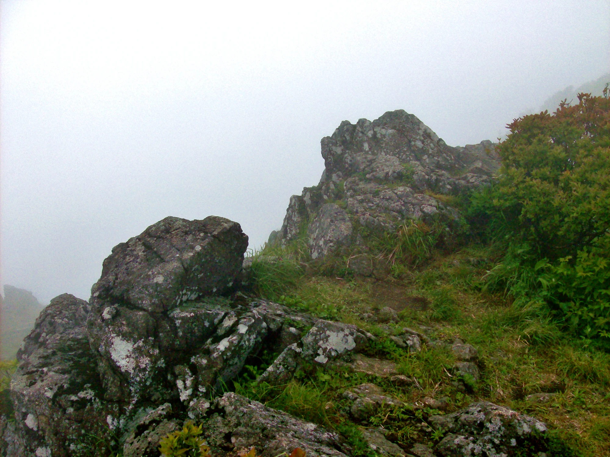
Lichen-marked rocks, green grasses and shrubs on a mountainside disappearing into dense white mist.

Mist closes around rocks and low vegetation on Sobaeksan, photographed in June 2008.

“Sobaeksan”, Kyle (Kjmagnuson), Flickr. Taken 6 June 2008; uploaded 26 July 2014. CC BY 2.0. Unchanged. · Creative Commons

Getting there and practical advice

Use the entrance as your last planning stop

Ask the visitor-support centre about the route, toilets, weather and the day’s restrictions before starting. Cheondong’s published final toilet is well below the summit. Bring your own food and drinking water, carry out rubbish, and check any camping or shelter booking separately rather than assuming a day-walk route provides overnight accommodation.

Yeongju and Punggi for Huibang

The official rail guidance identifies Yeongju and Punggi as arrival points for the Huibang side. Arrange the last leg to Huibang Visitor Support Centre, not simply to a generic “Sobaeksan” map pin. KNPS distinguishes the first parking area and the higher second parking area, with the latter intended for small cars. Confirm road access and your return connection before walking. Check current local bus numbers and timetables before travelling.

Danyang for Cheondong

The official bus guidance routes visitors through Danyang town onto a local service toward Cheondong and Darian Tourist Area. The route-start listing pairs Cheondong’s information point at 103 Sobaeksan-deungsan-gil with Darian Tourist Area parking. Check the last return bus or arrange pickup before beginning a full-day hike; do not assume a convenient service will be waiting when you descend.

Match the surface to the person

The most manageable plan here may be a short portion of the lower valley, with an early turn back. Huibang’s waterfall stairs, Cheondong’s stones and Jukryeong’s long paved incline create different obstacles. Tell the park office your actual mobility needs when checking access; a car park or a paved path alone does not establish a usable visit.

Sources and useful links

Wildlife you might spot

3

Each card links to a full Explore page with photos, traits, and fun facts.

Snap map for this place

Start with the big picture, then zoom in to explore individual wildlife observations around this place.

Loading map…

Good to know before you go

Choose an out-and-back route unless you have arranged transport at a different trailhead.

Carry drinking water, food, a waterproof, a warm layer and a charged phone; do not rely on summit refreshments.

Start well before the last permitted entry time, with enough daylight and energy for your descent.

Use the signed trail through flower and yew habitats; never step over protection ropes for a photograph.

Keep narrow stairs and summit paths clear while resting or taking pictures.

Save the Korean gateway name

희방탐방지원센터 for Huibang or 천동탐방지원센터 for Cheondong.

Frequently asked questions

Walk the lower Huibang route to the waterfall and temple, then return the same way. It still has stairs, but you can enjoy the valley without committing to the much steeper climb above the temple.
Its gradient is generally gentler than Huibang’s, but the published return is 13.6 km. Stony footing, accumulated distance and exposed upper ground make it a proper mountain day.
Several summit trails connect, but different exits leave you far from your starting vehicle or bus stop. For a first visit, return to your own gateway; arrange a point-to-point itinerary and transport separately.
There is no dependable visitor sighting opportunity. These are protected animals in a restoration landscape. If one appears, watch quietly from a distance, never feed or follow it, and leave it an unobstructed escape route.
No. Seasonal entry hours still apply, and the last entry time is not a recommended summit start. Weather, temporary controls and instructions at the entrance take precedence.

Recent snaps at this place

Recent snaps will appear here as new observations are added.

View all ›

Take the discovery with you

Exploring Sobaeksan National Park?

Identify the wildlife you spot, learn as you go, and keep a collection of the adventure.

  1. 1Spot it
  2. 2Snap it
  3. 3Keep the discovery