
Snappit logo
Snappit
Get App
Generic illustration, not a photograph of this venueIllustration
ParkKR

Yeoninsan Provincial Park

For a first visit, start on the Yongchu Valley side at the visitor information centre and let your time, footing and the day’s water conditions decide how far you go.

About

For a first visit, start on the Yongchu Valley side at the visitor information centre and let your time, footing and the day’s water conditions decide how far you go. Sorit-gil offers the lower-valley introduction; Myeongpum Valley Trail takes you farther into the wooded stream corridor. The northern Baekdun-ri approach is a separate choice for ridge walking and spring flowers. You do not need to reach a summit or complete a named trail to have a satisfying visit here. Unlock an interactive field guide for this spot: get the Snappit app to identify nature on the go.

Yeoninsan received its present name through a local naming process in 1999, expressing an association with love and friendship, and became a provincial park in 2005. The valley also preserves a less romantic, everyday history: former hillside farming homes, charcoal-making sites and a branch-school site recall communities that lived here. Treat these remains as places to learn from, not ruins to climb over.

What to do here

Follow the signed valley path, pause at stream viewpoints and read the interpretation about the people who once lived and worked in these hills. Bring a camera for water, woodland and seasonal flowers, but take photographs from the path rather than balancing on a crossing. If you want a summit day, choose your ridge approach before setting out and carry a proper walking map.

Seasonal info

Spring flowering varies with elevation and the year; ask about the Baekdun-ri ridges rather than expecting every valley walk to have the same blooms. In hot weather, start early and bring enough drinking water. After rain, check the actual crossings before committing to a long route. In autumn and winter, plan to finish well before darkness.

Accessibility

Do not treat “valley walk” as a step-free promise. Stone crossings, uneven ground, slopes and bridges can make Sorit-gil and Myeongpum-gil unsuitable for some wheelchair, stroller or limited-balance users. Ask the visitor centre for a currently usable short section that matches your needs; the full valley route is not presented here as accessible.

Don't miss

1

Water and woodland along Yongchu Valley, with a flexible shorter visit from the lower entrance.

2

Myeongpum-gil’s stream crossings and the remains of former mountain settlements.

3

Spring wildflowers and azaleas on the Baekdun-ri side of the park.

4

A demanding summit option for equipped walkers who want a separate mountain day.

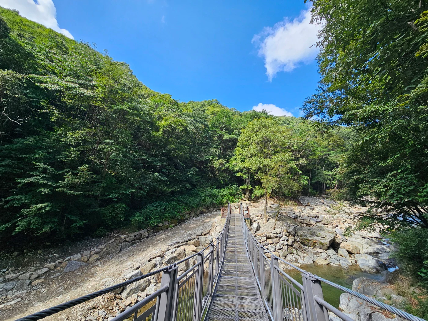
A narrow metal footbridge crosses a rocky stream beneath densely wooded hills and a bright blue sky.

A footbridge and wooded stream in Yeoninsan’s Yongchu Valley, in a photograph published by Gyeonggi Province on 8 September 2026. The exact bridge and capture date are unconfirmed; conditions may differ when you visit.

Photo: “연인산 (3).jpg,” Gyeonggi Province, Garden Industry Division, published 2026. [Original source and free download](https://gnews.gg.go.kr/briefing/brief_gongbo_view.do?BS_CODE=s017&number=71419). [KOGL Type 1 (Attribution)](https://www.kogl.or.kr/info/licenseType1.do). Original attachment unchanged; no endorsement implied. · www.kogl.or.kr

Walks and routes

Start gently: a lower Sorit-gil out-and-back

Begin at the visitor information centre on the Yongchu side and follow the signed Sorit-gil route. Yongchu Falls and Musongam are named features of this lower corridor. Choose a turnaround according to your group rather than treating the upper valley as a compulsory finish. The lower route reaches the Yongchu bus terminus, but check where your own bus stops before using it as a one-way transport plan.

A shorter distance reduces exertion; it does not remove rough footing or crossing barriers. Inspect the first difficult section before committing the whole group.


Start gently: a lower Sorit-gil out-and-back

Walk farther: the full Yongchu Valley route

The current published route runs from the visitor centre through Sorit-gil to the Myeongpum-gil endpoint: 9.2 kilometres one way. The province quotes about 2½ hours one way, an estimate that leaves little room for lingering. For a same-way return, the arithmetic is 18.4 kilometres; use the longer day allowance below and turn back earlier if needed. There is no verified end-of-trail shuttle in this guide.

Repeated crossings and uneven surfaces demand confident footing. Wet stone and ice can change the difficulty sharply; distance alone is a poor measure of suitability.

Walk farther: the full Yongchu Valley route

For strong walkers: Gyeonggi Dulle-gil Course 19

The official Boagwigol–Yeoninsan–Kalbongsan Shelter–Yongchu Valley route is 15 kilometres and rated very difficult, with a published time of 7½ hours. It crosses the 1,068-metre summit; the approach from Boagwigol involves roughly 800 metres of height difference. This is a mountain traverse with different start and finish points, so arrange the transport and navigation before leaving.

Steep, sustained mountain walking. It is not a family extension to the lower valley stroll and is unsuitable as a step-free option.

For strong walkers: Gyeonggi Dulle-gil Course 19

A relaxed first visit

Allow 1–2 hours on site. Begin by checking conditions at the visitor centre, then take an open lower section of Sorit-gil. Save time for a stream viewpoint and a pause rather than chasing distance. Turn around early enough for a comfortable return, with extra margin if children need frequent breaks. Add a booked activity only if its timing and location are confirmed.

A full valley day

For fit walkers in good conditions, set aside roughly 6–8 hours for the return journey from the visitor centre to the published upper endpoint. Pack lunch and water, start early and set a firm turnaround time. Reaching the end is optional; crossing safely and getting back in daylight are the priorities. Do not add the summit as an impromptu extra.

A separate spring ridge day

Choose Baekdun-ri if mountain wildflowers are your main reason for coming. The province identifies Jangsu and Somang ridges as summit approaches from that side. Ask the park which route suits your group and is currently open, then plan a complete mountain day around its actual distance and return. Do not combine a northern trailhead and a Yongchu finish without arranging onward transport.

Things to try

Follow the valley’s human history

Look for interpretation of former hillside farming communities, charcoal kilns and the Naegok branch-school site along the valley route. These clues explain why a seemingly secluded forest has paths and settlement traces. Read what is visible from the marked trail and leave stones and objects undisturbed.

Ask about a guided forest session

The park has offered nature interpretation and craft activities, with enquiries through the visitor centre and the Gyeonggi Shared Service booking site. Ask what is actually running on your date, its language, age range, price and meeting point. A programme can be a better fit for young children than a long, crossing-heavy walk.

When the valley is a poor choice

If heavy rain is forecast or staff advise against the route, postpone the stream walk. A confirmed indoor craft session at the visitor centre may work on an ordinary rainy day, but it is not a reason to travel into a valley under severe-weather restrictions. Ask about cancellations first and choose an activity outside the affected area if access itself is unsafe.

Wildlife and habitats

Rhododendrons and azaleas

The higher ridges are known for spring azalea colonies. Plan a ridge outing if these are your goal; a lower-valley stroll may miss them. Enjoy flowers from the trail and avoid leaning into shrubs for photographs. Use the trail’s plant labels or ask a nature guide for a more specific identification.

Pines

Korean pine forest is part of Yeoninsan’s landscape, with some stands occupying former hillside cultivation sites. That history is a reminder that a forest can reflect both ecological change and human land use. Leave cones and seeds for the woodland, and use local plant labels to identify the trees you see.

Spring flowers beneath the trees

The park’s April 2026 Baekdun-ri report records eolleji and yellow-flowered violets. Eolleji, Erythronium japonicum, has conspicuously swept-back petals when flowering. Look from the existing path and use a zoom rather than stepping into a patch. These are seasonal possibilities, not promised sightings on a particular visit.

Stories and discoveries

One park, several very different entrances

The protected landscape spans Gapyeong-eup, Jojong-myeon and Buk-myeon within Gapyeong County. Yongchu Valley, the Baekdun-ri ridges and the summit belong to the same park. Choosing the wrong side can leave you far from the walk you intended, so share the exact entrance name with your driver.

When to visit

Spring: choose your elevation

Late April is a useful starting window for asking about Baekdun-ri wildflowers, followed by the ridge azaleas in May. Actual flowering shifts with weather and height, so use a current park update before travelling specially. Keep to the path: trampling for a close-up can damage the plants that make this season worth visiting.

Summer, autumn and winter

In summer, put the rain forecast ahead of the desire for cool streamside air. In autumn, carry a warmer layer and leave daylight for the return. For winter outings, assess ice before starting and shorten the plan if your equipment or experience is inadequate. Do not test a frozen pool or assume that a dry-looking stone has traction.

Getting there and practical advice

Visitor information, toilets and parking

The main lower-valley information point is 연인산도립공원 탐방안내소, at 229-41 Yongchu-ro, Gapyeong-eup, Gapyeong-gun. The Korea Tourism Organization lists parking and toilets and describes admission and parking as free. Confirm current arrangements for your chosen lot and any separate activity fee. Use toilets before a longer walk, and ask which facilities are operating farther along the route.

Playground and refreshments

Official park information describes a woodland playground along Sorit-gil. Check that it is open and suitable for your children before making it the centre of the trip. Bring your own supplies for a long walk; this guide does not promise a shop, café or drinking-water refill at the upper endpoint.

Arriving without a car

The province describes access from Gapyeong Station by local bus to the Yongchu terminus. Check current services, the stop nearest your intended starting point and the last return before travelling; no bus number or timetable is assumed here. Save the Korean destination and have a backup plan for the return rather than counting on an immediate taxi at the upper trail end.

Arriving by car

For the lower valley, search for the visitor centre rather than a generic mountain pin. Baekdun-ri is a different approach, and a point-to-point ridge hike will not return you to your parked car. Do not drive farther into the valley merely because a map shows a road; obey current vehicle restrictions and keep entrances and emergency access clear.

Ask about the whole access chain

An older provincial report describes an approximately 80-metre barrier-free deck by Yongchu Falls. That is useful as a question to ask, not proof of a current wheelchair route after flood repairs. Confirm parking-to-deck access, steps, gradients, surface width and an accessible toilet directly with the visitor centre. Anyone unable to step safely between stones should choose a confirmed no-crossing section or another outing.

Useful phone numbers

Visitor information: 031-8008-8140. For programme enquiries, the province also lists 031-8008-8145. Gyeonggi Dulle-gil enquiries: 031-259-4715. If calling from abroad, use +82 and omit the first 0. Ask about your exact entrance and route, especially after rain.

Sources and useful links

Wildlife you might spot

2

Each card links to a full Explore page with photos, traits, and fun facts.

Snap map for this place

Start with the big picture, then zoom in to explore individual wildlife observations around this place.

Loading map…

Good to know before you go

Check the day’s trail notice and forecast before leaving; a reopening announcement cannot guarantee safe water levels today.

Save your starting point in Korean

연인산도립공원 탐방안내소 for the lower valley, or 백둔리 for the northern approach.

Wear grippy walking shoes and keep your hands free on stepping stones.

Budget the return journey before walking farther upstream; the end of a named trail is not automatically a transport pickup point.

Carry water, food, a charged phone and an offline map; do not depend on refreshments deep in the valley.

Leave flowers, cones and stream wildlife where they are. Keep children close beside water and at crossings.

Frequently asked questions

Yes. Gyeonggi Province announced the full 9.2-kilometre Sorit-gil–Myeongpum-gil valley route reopening from 11 September 2026, and the official Gyeonggi Dulle-gil notice confirms Course 19 is available again. Check the latest notice and on-site signs for any new weather-related restrictions.
No. It describes the named upper valley trail in earlier official material. The September 2026 announcement gives 9.2 kilometres one way from the visitor centre, via Sorit-gil, to the Myeongpum-gil endpoint. Walking back to the same start doubles the distance.
Do not plan on completing it. A short purpose-built deck does not establish a continuous accessible route through the park. Confirm the approach, gradient, surface, toilet and turning space for the exact section you want to use.
This guide recommends enjoying the stream from the marked route. Do not infer permission to enter water from a photograph or other visitors’ behaviour. Follow current signs and staff instructions; never enter swollen water or move around a closed crossing.
No. Lower Yongchu Valley is a worthwhile visit in its own right. The summit is a separate mountain objective requiring more time, fitness, equipment and attention to the return route.

Recent snaps at this place

Recent snaps will appear here as new observations are added.

View all ›

Take the discovery with you

Exploring Yeoninsan Provincial Park?

Identify the wildlife you spot, learn as you go, and keep a collection of the adventure.

  1. 1Spot it
  2. 2Snap it
  3. 3Keep the discovery






