
Snappit logo
Snappit
Get App
Generic illustration, not a photograph of this venueIllustration
ParkAuvergne-Rhône-Alpes, FR

Massif des Bauges Regional Nature Park

The Massif des Bauges stretches across Savoie and Haute-Savoie in Auvergne-Rhône-Alpes.

About

The Massif des Bauges stretches across Savoie and Haute-Savoie in Auvergne-Rhône-Alpes. Limestone cliffs give it a striking outline, while villages, woodland and farmland fill the interior. Its regional nature park status reflects that combination of nature and everyday life. Chambéry, Aix-les-Bains, Rumilly, Annecy and Albertville are surrounding gateway cities; a holiday based beside a nearby lake is not automatically a visit inside the park.

For a first family outing, choose one small part of this large landscape. La Gornaz, in Les Déserts, provides shade, interpretation and an out-and-back format that lets you turn around before anyone is tired. The official description calls the route very easy. Treat that as a walking grade: this remains a mountain woodland with natural ground and nearby cliff country, rather than a surfaced town-park circuit.

The wider Bauges contain mountain forests, rock habitats, flower-rich grasslands and peatlands. These places need different kinds of visits. A forest stroll does not prepare a family for an exposed summit, and a summer pasture is somebody’s workplace. Keeping this visit on the signed woodland route leaves time to notice what is directly around you, without adding a second, more demanding destination. Don't forget to bring the Snappit nature identification app along to scan local species.

The Bauges became a regional nature park in 1995. Their geological heritage later brought Geopark recognition in 2011. At La Gornaz, the woodland has its own human history: the park describes former pasture subsequently planted with spruce, now with a more varied tree mix. Reading a forest therefore means looking at both natural growth and past choices.

What to do here

Follow the Gornaz interpretation route, stopping at the panels and looking for contrasting tree shapes, retained habitat trees and signs of forest life. Save the optional Col du Pertuiset viewpoint for a separately assessed outing; the woodland itself is the focus here.

Seasonal info

Spring can bring wet ground and remaining snow; autumn brings shorter days and possible forestry or hunting activity. In winter, use current designated snow routes and local advice rather than treating the summer woodland itinerary as an all-season walk.

Accessibility

No wheelchair or pushchair standard is published for this route. The very-easy walking grade does not establish step-free access. Ask La Féclaz tourist information about present surfaces, gradients, obstacles and a suitable alternative before travelling with mobility equipment.

Don't miss

1

Habitat trees retained for the forest’s other inhabitants

2

A shaded interpretation walk with an easy return along the same line

3

Spruce, fir and beech as an introduction to mountain woodland

4

A lived-in regional park, where nature and local work overlap

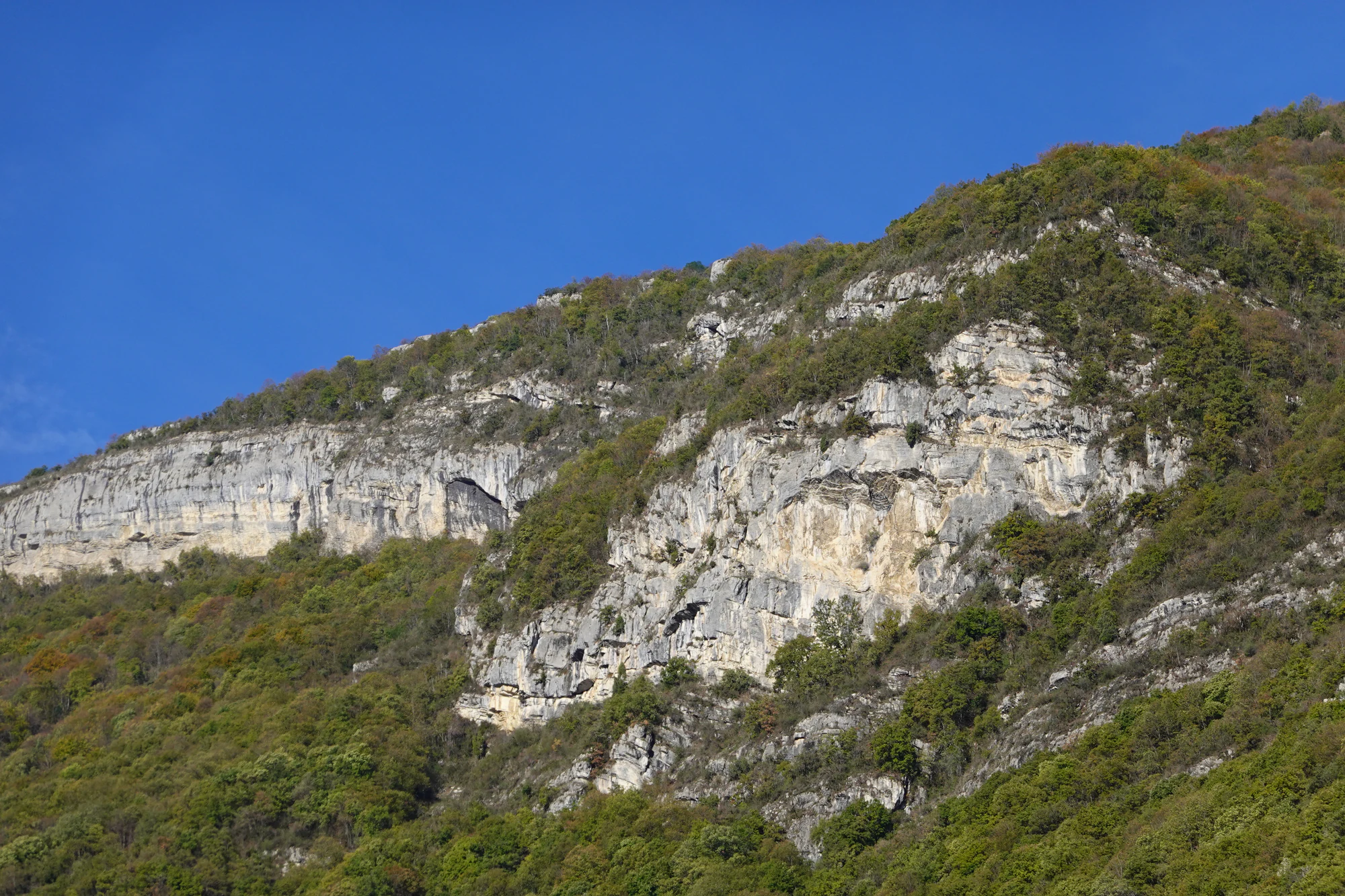
Pale layered cliffs rise above green and autumn-coloured woodland under a clear blue sky.

Wooded cliffs of the Bauges above Montmélian, photographed on 25 October 2022. This wider massif view does not show the Gornaz trail.

“Bauges @ Montmélian” — Guilhem Vellut, CC BY 2.0. Source: https://www.flickr.com/photos/o_0/52459605567/. License: https://creativecommons.org/licenses/by/2.0/. Original unchanged. · Creative Commons

Walks and routes

Sentier de la Gornaz: the woodland choice

Start at the Parc Aventure Forestier Le Pertuiset parking, near La Féclaz. Follow the signed GRP walking line into the property, then the pedestrian branch indicated by the directional sign. Continue along the interpretation trail to the property limit described in the official itinerary and return the same way. Keep to the indicated walking connection where activity tracks meet; do not take separate mushing circuits. Omit the optional side trip to the Col du Pertuiset viewpoint. Use the official route sheet and signs together, and turn back if either the route or access becomes unclear.

Natural woodland terrain; surfaces, minimum widths, gradients and any steps have not been audited. A shortened out-and-back can reduce walking time, but it does not by itself make the path wheelchair-accessible.


Sentier de la Gornaz: the woodland choice

An unhurried half-day

Before setting out, check the weather and ask about local access if conditions are uncertain. At the start, decide on a turnaround time and let everyone know which signed route you are following. Use the outward walk for the interpretation stops and the return for a tree comparison or photographs. Finish with your own water and snack, then decide whether the group has energy for anything else. A comfortable first mountain outing is a better result than an ambitious second stop squeezed into the day.

Things to try

Try a three-tree comparison

Choose three trees visible from the path and sketch a quick outline of each. Compare the crown, bark and leaves or needles before looking at a name. Children can work as a pair: one describes a feature while the other tries to find the same tree. The aim is to notice differences, not to finish a species checklist.

Read the forest’s different jobs

Use an interpretation stop to ask what a forester, walker and woodland animal might each need from the same place. Then look for evidence in view: a marked tree, a maintained track, a patch of young growth. Discuss which needs fit together and which require space or timing. Keep the exercise on the visitor path, leaving all markings and equipment untouched.

Make a return-journey photograph

On the outward walk, choose one view of trunks and branches that catches your eye. Find the same view on the return and see whether the light or your attention has changed. Take photographs from firm ground on the path. This gives the return a purpose without sending children off to collect objects or find a new route.

If the forest walk is a poor choice

In strong wind, a thunderstorm or difficult snow conditions, postpone Gornaz. A useful indoor substitute is to open the park’s Biodiv’Bauges atlas and compare spruce, fir, beech and black woodpecker before a later visit. If you are already staying nearby, ask the local tourist office for an indoor activity open that day rather than assuming a mountain visitor centre is open year-round.

Wildlife and habitats

Norway spruce — Picea abies

Spruce is a good starting point for a woodland comparison. Look for a pointed crown and long cones hanging down; whole fallen cones are another clue. The park’s atlas records Norway spruce in Les Déserts, while the Gornaz trail account explains the local history of spruce planting. Not every evergreen is a spruce, and the planted origin of a stand is part of its story. Photograph features where you can see them from the path rather than pulling a branch down.

Silver fir — Abies alba

Fir provides the comparison: its cones stand upright and break apart on the tree, and its needles have two pale lines underneath. The park’s atlas records it in Les Déserts. Young firs can wait in shade for a long time, so a small tree need not be a very young one. If a branch is safely visible at eye level, look without detaching it; otherwise leave the identification open.

European beech — Fagus sylvatica

Beech adds a broad-leaved shape to the conifers. Smooth grey bark and oval leaves with gently wavy edges are useful clues. Its nuts sit in prickly cases that open in autumn. It is also recorded in Les Déserts by Biodiv’Bauges. A fallen leaf can be examined where it lies, then left in place. Compare several features before settling on a name: one leaf shape on its own can be misleading.

Black woodpecker — Dryocopus martius

This large dark woodpecker, with red on the head and a pale bill, is recorded in Les Déserts. Its excavated cavities can later shelter other species, making it a useful example of how one forest resident helps others. You may hear a bird without seeing it. Listen from the trail, avoid playback calls and never inspect a nest hole. Holes in wood alone are not enough to identify which animal made them.

Stories and discoveries

The cliff is part of a much longer story

The Bauges’ limestone began as marine sediment before Alpine mountain-building transformed the region. The park’s Geopark identity encourages visitors to connect that geological history with the landscape they see today. You do not need to approach a rock face or enter a cave to appreciate it: a distant view and a good interpretation panel are enough.

A tree can stay useful after it dies

Retained standing and fallen deadwood provides food and shelter, then contributes to the forest floor as it breaks down. At Gornaz, ecological-interest trees are identified with a painted triangle. Leave them undisturbed: the value lies in their remaining part of the woodland, not in making a tidy trail-side display.

When to visit

Spring and summer

Wait until the intended path is clear of snow and safe underfoot. After rain, choose a shorter outing rather than stepping around mud into the forest. In summer, check thunderstorm timing before driving up; postpone if the weather would make a wooded walk unsafe. Bring water from the outset rather than planning around an unverified refill point.

Autumn and winter

Autumn colour can make tree comparisons rewarding, but give yourself a generous daylight margin and obey temporary work or hunting signs. Once snow covers the ground, route use changes. The park asks visitors to protect wildlife’s winter resting areas and to check current sensitive-zone information. Do not invent a snowshoe line through quiet woodland or follow tracks simply because someone else has made them.

Getting there and practical advice

Arrive prepared for a walking trail

The official start is the adventure-park parking area, about 2 km towards Le Revard from La Féclaz. Do not assume that the nearby business’s toilets, refreshments or opening hours apply to walkers. Bring what you need. La Féclaz tourist information is the useful first contact for route conditions and local services.

Driving and parking

Use the named Parc Aventure Forestier Le Pertuiset starting point rather than a generic search for the whole Bauges park. Follow current road and parking signs. If the designated area is full, choose another time instead of parking on a forest access, a verge or a private entrance.

Coming without a car

Synchro’s line 40 links Chambéry and La Féclaz during its operating seasons. The summer 2026 service ran from 4 July to 30 August; that timetable does not establish an October journey or a future summer service. Check the current outward and return timetable first, then ask tourist information about a safe pedestrian connection to Gornaz. Do not count a bus to the station as delivery to the trailhead.

Match the outing to the person

For someone who needs a firm surface, regular seating or a step-free route, obtain a specific local answer before departure. Ask about the parking-to-path connection as well as the woodland section. For children who walk independently, the same-way return makes a short visit possible, but an adult should lead at junctions and keep the group together near the Pertuiset sector.

Sources and useful links

Wildlife you might spot

4

Each card links to a full Explore page with photos, traits, and fun facts.

Snap map for this place

Start with the big picture, then zoom in to explore individual wildlife observations around this place.

Loading map…

Good to know before you go

Download the official route before leaving and read the entrance signs on arrival.

Wear shoes with grip and carry water, a warm layer and a waterproof, even on a short visit.

Choose an early turnaround time with children; the return still needs energy and attention.

Keep a dog close on a lead and check local restrictions before bringing it.

Leave cones, fungi, deadwood and plants where they are. Photographs make a better collection.

Keep access for forestry and emergency vehicles clear when parking.

Frequently asked questions

No. Gornaz is one introduction in the Les Déserts sector. The park spans two departments and many communes, with very different habitats and levels of difficulty. Choose other days around specific places rather than trying to cover the massif in a single outing.
It is optional in the official description and is not part of the woodland-focused family suggestion here. Nearby cliffs and quiet zones deserve care. Do not follow an attractive side path merely because the main outing has a very-easy grade.
The official walking sheet does not state a ticket price, booking requirement or fixed opening hours. Check present access with La Féclaz tourist information. The neighbouring adventure park and dog-led activities have their own operators, seasons and charges.
Make this an observation visit. Much of the countryside is privately owned, and access along a trail does not give permission to collect or rearrange it. Dead branches, fungi and leaf litter are also part of the habitat you have come to discover.

Recent snaps at this place

Recent snaps will appear here as new observations are added.

View all ›

Take the discovery with you

Exploring Massif des Bauges Regional Nature Park?

Identify the wildlife you spot, learn as you go, and keep a collection of the adventure.

  1. 1Spot it
  2. 2Snap it
  3. 3Keep the discovery







