


Jun 6, 2026
ParkWisconsin, US
Mazo Beach
Discover the serene beauty of Mazomanie Bottoms State Natural Area, a vital floodplain ecosystem.
About
Discover the serene beauty of Mazomanie Bottoms State Natural Area, a vital floodplain ecosystem. Colloquially known as Mazo Beach, this natural gem offers a tranquil escape along the Lower Wisconsin River, though its famed beach section has been closed since 2016 due to past issues. Today, the focus is on the expansive 352-acre natural area, encompassing diverse habitats like floodplain forests, old river channels, and sandbars. It's a sanctuary for a remarkable array of wildlife and a paradise for nature enthusiasts.
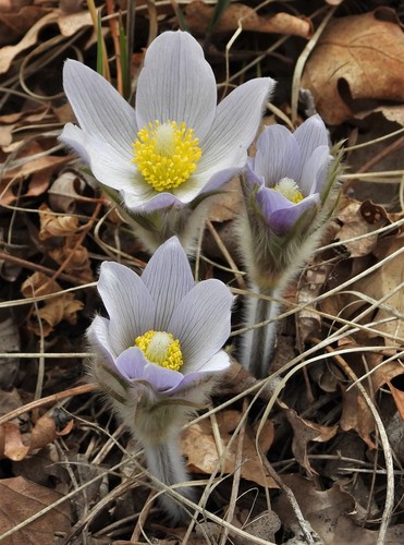
The natural area is characterized by its magnificent bottomland forest, dominated by towering silver maple, elm, basswood, and ash trees, alongside swamp white oak, cottonwood, and willow. This lush environment supports a rich understory of plants, including gray dogwood and prickly ash, and an abundance of vining species like virgin's bower and wild yam. Birdwatchers will be particularly delighted by the thousands of migrating birds that pass through, as well as nesting species such as cerulean and prothonotary warblers. In winter, the area becomes a critical roosting site for bald eagles.
Visiting Mazomanie Bottoms State Natural Area is an opportunity to immerse yourself in a pristine Wisconsin ecosystem. It's a place for quiet contemplation, rigorous hiking, and exceptional wildlife photography. While the sandy riverbanks that once drew sunbathers are no longer publicly accessible, the natural area continues to offer profound experiences for those seeking to connect with the wild beauty of Wisconsin's riverine landscapes and observe its diverse flora and fauna in their natural setting. Turn your visit into a safari! Use the Snappit app to scan and log wildlife sightings here.
Mazo Beach is the popular name for the Mazomanie Bottoms State Natural Area, which was designated in 1978. The State of Wisconsin began acquiring land along the Wisconsin River in this area as early as the 1950s, with the goal of providing diverse nature-based activities and protecting wildlife habitat. For decades, the area, particularly its expansive shoreline, attracted visitors for picnicking and swimming. However, the site gained notoriety as a clothing-optional beach, which eventually led to significant management challenges. Following persistent issues with illegal activities, including public sex acts and drug use, the Wisconsin Department of Natural Resources (DNR) took steps to restrict access. After a period of weekday closures, the DNR ultimately closed the entire Mazo Beach area to public access indefinitely on March 8, 2016. While the DNR is updating its master plan for the broader Mazomanie Recreation Management Area, Mazo Beach itself was not included in these redevelopment plans, and public access to the beach remains closed.
What to do here
Hiking: Explore the extensive network of management roads and potential undesignated footpaths within the natural area.
* **Wildlife Viewing: ** Look for a variety of birds, including uncommon warblers in spring and fall, and bald eagles in winter. Keep an eye out for deer and other woodland creatures.
* **Birdwatching: ** A premier destination for observing migrating and nesting bird species.
* **Photography: ** Capture the beauty of the river landscape, dense forests, and diverse wildlife.
* **Hunting and Fishing: ** These activities are generally permitted on DNR-owned State Natural Area lands, but visitors should check with the Wisconsin DNR for specific regulations and seasons.
Seasonal info
Weather: Wisconsin experiences distinct seasons. Summers are warm and humid, winters are cold and snowy. Spring and fall offer moderate temperatures.
Animal activity: Migratory birds are most active in spring and fall. Bald eagles are prominent in winter.
Seasonal events: No specific events are hosted within the natural area itself.
Accessibility
Generally, State Natural Areas like Mazomanie Bottoms have very few public facilities, meaning no paved trails, restrooms, or picnic areas. Access to the natural area is primarily via walking along management roads from designated parking lots off County Y, which can involve a walk of 0.6 to 1.5 miles into the interior. Visitors should expect natural terrain.
Don't miss
1
The primary highlight is the natural floodplain forest ecosystem and the Wisconsin River itself. There are no traditional exhibits.
Wildlife you might spot
12Each card links to a full Explore page with photos, traits, and fun facts.
We are still adding species preview cards for this place.
Snap map for this place
Start with the big picture, then zoom in to explore individual wildlife observations around this place.
Loading map…
Good to know before you go
Wear appropriate footwear for natural, unpaved terrain, as trails are typically undesignated footpaths or service roads.
Bring binoculars for birdwatching, especially during migration seasons and in winter for bald eagles.
Carry water and snacks, as there are no facilities like restrooms or picnic areas within the natural area.
Be aware of hunting seasons if visiting during fall and wear blaze orange for safety.
Prepare for insects, especially during warmer months, and consider bringing insect repellent.
Check the Wisconsin DNR website for current conditions, regulations, and any temporary closures before visiting.
Frequently asked questions
- No, the Mazo Beach area, including its sandy shoreline, has been closed to public access indefinitely by the Wisconsin DNR since March 8, 2016, due to safety concerns and illegal activities. The natural area surrounding it, Mazomanie Bottoms State Natural Area, remains open for other recreational activities.
- Visitors to Mazomanie Bottoms State Natural Area can enjoy activities such as hiking, wildlife viewing, birdwatching, hunting, and fishing. It's an excellent location for immersing oneself in nature and photography.
- Access is available from the south or east off County Y. There are designated DNR parking lots, from which visitors can walk along management roads into the natural area. Expect a walk of 0.6 to 1.5 miles to reach the interior.
Recent snaps at this place


Jun 1, 2026


May 31, 2026


May 31, 2026


May 30, 2026
More park guides
View all ›
Park166 sightings50 species
Maryland, US
Rock Creek Regional Park
You might spot White-Tailed Deer and Eastern Gray Squirrel.
View guide →
.jpg)
Park100 sightings50 species
District of Columbia, US
Canal Park
You might spot Eastern Gray Squirrel, Duck, and House Sparrow.
View guide →

Park92 sightings50 species
Illinois, US
Humboldt (Alexander Von) Park
You might spot American Robin, Canada Goose, and House Sparrow.
View guide →
Park88 sightings50 species
Virginia, US
Chantilly Park
You might spot Spotted Lanternfly and Northern Cardinal.
View guide →