


Baldcypresses

Fort Defiance offers stunning panoramic views where the Ohio and Mississippi Rivers dramatically merge.
Fort Defiance offers stunning panoramic views where the Ohio and Mississippi Rivers dramatically merge. This significant historical park sits at the southernmost tip of Illinois, providing a unique vantage point of two of America's most iconic waterways. It's a place where natural beauty intertwines with a rich military past, inviting visitors to reflect on centuries of history and the power of nature.
The park's primary draw is the awe-inspiring confluence itself, where visitors can distinctly witness the lighter waters of the Ohio River meeting the muddier currents of the Mississippi. Interpretive signage throughout the park details its crucial role during the Civil War as a Union stronghold and provides context for the strategic importance of this geographical location. While not a zoo or botanical garden in the traditional sense, the park's natural setting allows for observations of diverse riparian bird species and the majestic riverine landscape.
Visiting Fort Defiance is a memorable experience, offering both educational insights and breathtaking scenery. It's an ideal spot for photography, picnicking, or simply enjoying the tranquil sounds of the converging rivers and observing barges navigate the historic waters. The combination of historical depth, ecological interest, and spectacular views makes it a compelling destination for anyone exploring southern Illinois. Explore the grounds like a pro—download the Snappit app to instantly identify animals and plants.
Fort Defiance holds a significant place in American history, primarily due to its strategic location at the confluence of the Ohio and Mississippi Rivers. During the American Civil War, General Ulysses S. Grant recognized the critical importance of this point for controlling river traffic and supply lines. In 1861, Union forces established a fortification here, naming it Fort Defiance, which became a vital base of operations for campaigns in the Western Theater. The fort played a key role in the Union's early successes, including the capture of Fort Henry and Fort Donelson. Its position allowed the Union to control navigation on both rivers, effectively cutting off Confederate supply routes and movements. While the original earthenworks and structures of the Civil War-era fort are no longer standing, the site remains preserved as a state park, commemorating its historical significance and offering visitors a tangible connection to this pivotal period.
Enjoy panoramic river views, learn about Civil War history, picnic, photograph the confluence, and observe local wildlife (especially birds).
Summers can be hot and humid, so bring water and sun protection. Winters are generally mild but can be chilly and windy near the river; dress in layers. Spring brings potential for flooding, which can sometimes impact accessibility to certain areas of the park.
The park generally offers paved parking and pathways leading to key viewing areas, making it accessible for visitors with mobility considerations. Specific details on ramp access or trail surfaces may vary, but the main overlooks are typically designed for ease of access.
The primary highlight is the **Confluence Overlook**, offering a direct view of where the Ohio and Mississippi Rivers meet. Visitors can also explore various **interpretive historical markers** detailing the fort's Civil War significance and observe the **historic river navigation** by barges and towboats.
Each card links to a full Explore page with photos, traits, and fun facts.
Start with the big picture, then zoom in to explore individual wildlife observations around this place.
Bring binoculars
** Enhance your experience by spotting distant barges, birds, and features along the riverbanks.
Visit on a clear day
The views of the confluence are best on sunny days, allowing for clearer distinction between the two rivers.
Wear comfortable shoes
While main paths are paved, exploring the full extent of the park might involve some walking.
Pack a picnic
There are picnic tables available, offering a perfect setting to enjoy a meal with a view of the rivers.
Check river levels
Inquire locally or check online for river conditions, as very high water levels can sometimes alter the visible dynamics of the confluence or close parts of the park.
Bug spray
Especially during warmer months, insects can be present, given the park's riverside location.
Apr 27, 2026
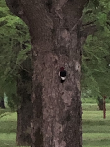
Photo attribution
(c) Joseph McPhail, some rights reserved (CC BY)
License: CC BY 4.0 ↗
Image may be shown cropped inside the card frame.
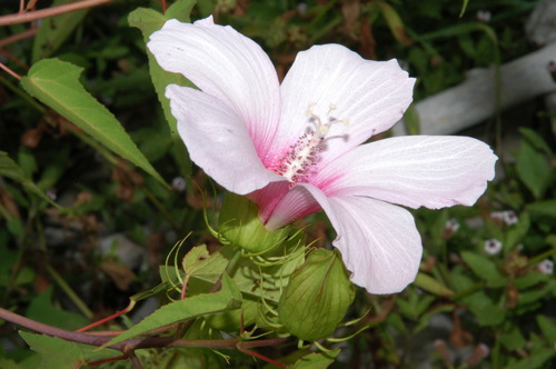
Jul 27, 2006
Photo attribution
(c) Brian Finzel, some rights reserved (CC BY-SA)
License: CC BY-SA 4.0 ↗
Image may be shown cropped inside the card frame.
May 30, 2026
Apr 9, 2026
Apr 8, 2026

Maryland, US
You might spot White-Tailed Deer and Eastern Gray Squirrel.
View guide →
.jpg)
District of Columbia, US
You might spot Eastern Gray Squirrel, Duck, and House Sparrow.
View guide →

Illinois, US
You might spot American Robin, Canada Goose, and House Sparrow.
View guide →
Virginia, US
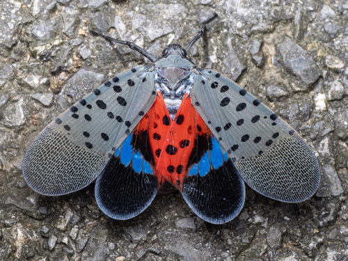
You might spot Spotted Lanternfly and Northern Cardinal.
View guide →