


Western Fence Lizard

Los Trancos Open Space Preserve offers an unparalleled opportunity to explore the legendary San Andreas Fault.
Los Trancos Open Space Preserve offers an unparalleled opportunity to explore the legendary San Andreas Fault. This 274-acre preserve, nestled in the Santa Cruz Mountains near Los Altos Hills, is a living classroom where geology comes alive. With its diverse landscapes and interpretive trails, Los Trancos provides a unique blend of natural beauty and geological education, making it a truly special destination in the Bay Area.
The preserve's crown jewel is the 1.5-mile San Andreas Fault Trail, featuring interpretive stations that vividly explain earthquake geology and the dramatic effects of past seismic activity, including a recreation of a fence line offset by the 1906 earthquake. Beyond the fault line, hikers will discover rolling grasslands, lush oak woodlands, and cool, shaded forests of California bay, Douglas fir, and big-leaf maple. Seasonal wildflowers like yellow mariposa lily and California poppy carpet the meadows in spring, while autumn brings a vibrant display of orange-red maples. Expansive views on clear days stretch across the San Francisco Bay to Mount Diablo, Mount Tamalpais, and even the distant peaks of Loma Prieta.
Visiting Los Trancos Open Space Preserve is an unforgettable experience, combining invigorating hikes with fascinating scientific insight. Whether you're a casual stroller or an avid geologist, the preserve's accessible trails and striking features offer a profound connection to California's dynamic landscape. It’s a place where you can witness the raw power of nature and gain a deeper appreciation for the ground beneath your feet, all while enjoying breathtaking panoramic vistas. Unlock an interactive field guide for this spot: get the Snappit app to identify nature on the go.
The land that now constitutes Los Trancos Open Space Preserve was once part of a much larger 13,300-acre rancho in the 19th century. In the early 1900s, state senator Louis Oneal acquired the acreage, utilizing it for horse breeding. During the 1950s and 60s, the property was eyed for residential development, with Palo Alto even extending water and power lines to the site. However, these development plans were ultimately abandoned due to the prohibitive costs of providing city services to the area. The preserve was officially acquired by the Midpeninsula Regional Open Space District in 1976, ensuring its preservation for public enjoyment and ecological protection. A year later, in 1977, the renowned 1.5-mile San Andreas Fault Trail was established with the invaluable assistance of volunteers and geology students, creating its signature educational experience.
Hike the well-maintained trails, learn about seismic activity, practice nature photography, observe native flora, and simply enjoy the tranquility and scenic beauty.
Spring: Wildflowers such as yellow mariposa lily, California poppy, fairy lanterns, and clarkia bloom in meadows.
Summer: Currant bushes may bear berries, and creek areas can become lush and "jungle-like."
Autumn: Big-leaf maples, hazelnut, and deciduous oaks provide a stunning display of fall colors, with madrones also contributing color before shedding bark.
Winter: Madrone trees produce bright berries, and the shaded forests offer a quiet, serene hiking experience.
The San Andreas Fault Trail is described as relatively flat with minimal elevation change, making it suitable for children and visitors seeking a less physically demanding outing. Other trails are generally easy to moderate, with some portions noted as "easily-accessible paths."
A 1.5-mile interpretive loop with nine stations explaining earthquake geology.
A striking visual representation of the three-foot offset caused by the 1906 San Francisco earthquake.
Depressions formed by fault activity, visible along the trail.
Enjoy sweeping views of Mount Diablo, San Francisco, Mount Tamalpais, Silicon Valley, and the Santa Cruz Mountains from various viewpoints.
Each card links to a full Explore page with photos, traits, and fun facts.
Start with the big picture, then zoom in to explore individual wildlife observations around this place.
Bring Water
** There is no drinking water available in the preserve, so carry enough for your visit.
Wear Appropriate Footwear
Sturdy hiking shoes are recommended for comfort and safety on the trails.
Beware of Poison Oak
This plant is common in the preserve; learn to identify it and stay on marked trails to avoid contact.
Protect Valuables
Do not leave valuables visible in your parked car, as the parking lot has been a target for thieves.
Grab a Trail Map/Brochure
Pick up an interpretive brochure for the San Andreas Fault Trail at the trailhead or download it via the OuterSpatial app for a self-guided educational experience.
Layer Up
Weather can change quickly in the Santa Cruz Mountains, so dressing in layers is advisable.
Jun 7, 2026
Jun 7, 2026
Jun 7, 2026
Jun 6, 2026
Jun 6, 2026

Maryland, US
You might spot White-Tailed Deer and Eastern Gray Squirrel.
View guide →
.jpg)
District of Columbia, US
You might spot Eastern Gray Squirrel, Duck, and House Sparrow.
View guide →

Illinois, US
You might spot American Robin, Canada Goose, and House Sparrow.
View guide →
Virginia, US
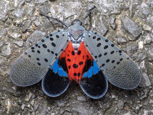
You might spot Spotted Lanternfly and Northern Cardinal.
View guide →


.jpg&width=800)


.jpg&width=800)