


California Poppy

The King Range National Conservation Area is where mountains dramatically meet the Pacific, creating California's legendary Lost Coast.
The King Range National Conservation Area is where mountains dramatically meet the Pacific, creating California's legendary Lost Coast. This rugged expanse boasts the longest undeveloped coastline outside of Alaska, a testament to its raw, untamed beauty. As the nation's first National Conservation Area, designated in 1970, King Range offers a pristine wilderness experience, free from coastal highways and bustling development.
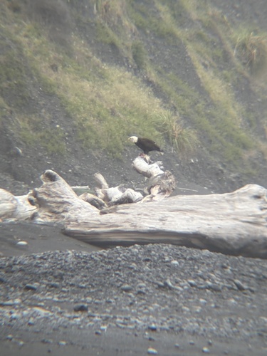
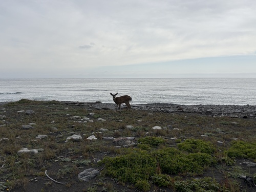
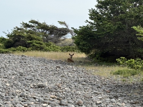
Traverse the famed Lost Coast Trail, a challenging multi-day backpacking adventure that winds along black sand beaches and through dense Douglas-fir forests, offering unparalleled ocean vistas. Wildlife abounds in this diverse landscape, from majestic Roosevelt elk grazing in coastal prairies and black bears roaming the hills, to observant bald eagles soaring overhead. Offshore, keep an eye out for harbor seals and California sea lions, while migrating grey whales can be spotted seasonally.
A visit to the King Range is an unforgettable journey into true wilderness, providing a rare opportunity for solitude and breathtaking natural encounters. Whether you're seeking challenging hikes, world-class mountain biking, dramatic photography subjects, or simply a tranquil escape under a blanket of stars, this remote sanctuary delivers an unparalleled outdoor experience. Explore the grounds like a pro—download the Snappit app to instantly identify animals and plants.
The King Range area, known as the "Lost Coast" due to its rugged terrain that prevented the construction of coastal highways and led to depopulation in the 1930s, holds a rich natural and cultural history. The land was historically home to various Native American peoples, including the Wiyot, Yurok, Mattole, Sinkyone, and Bear River tribes. The King Range National Conservation Area was established in 1970, marking it as the nation's very first NCA, to protect its unique geological features and diverse ecosystems. Later, in 2006, a significant portion of the area was further designated as the King Range Wilderness, ensuring its enduring preservation. Efforts have also been made to restore ecosystems, such as those along the Mattole River, which were impacted by past logging.
Backpacking, hiking, wildlife watching, photography, surfing, angling, mountain biking, beachcombing, stargazing, and mushroom collecting (with a permit).
**Seasonal notes: **
* **Spring: ** Enjoy abundant wildflowers like California blue blossom, monkeyflower, lupine, and California poppies. Baby seals can be seen in March and April.
* **Summer: ** Generally sunny, but expect higher visitor numbers.
* **Fall: ** Clear skies and pleasant temperatures, with fewer crowds than summer.
* **Winter: ** Can be very wet with heavy rains, making creek crossings hazardous or impassable, and leading to high tides and large waves along the coast. Snow can fall at higher elevations. Migrating grey whales can be observed offshore.
**Accessibility features: ** Roads into the King Range are narrow, steep, and winding; allow ample travel time. Main roads are typically accessible to passenger cars outside of heavy winter storms, but primitive roads may close seasonally. Many upland trails are strenuous due to steep terrain. Wilderness areas have minimal facilities and signing.
Spring: Enjoy abundant wildflowers like California blue blossom, monkeyflower, lupine, and California poppies. Baby seals can be seen in March and April.
Summer: Generally sunny, but expect higher visitor numbers.
Fall: Clear skies and pleasant temperatures, with fewer crowds than summer.
Winter: Can be very wet with heavy rains, making creek crossings hazardous or impassable, and leading to high tides and large waves along the coast. Snow can fall at higher elevations. Migrating grey whales can be observed offshore.
Accessibility features: Roads into the King Range are narrow, steep, and winding; allow ample travel time. Main roads are typically accessible to passenger cars outside of heavy winter storms, but primitive roads may close seasonally. Many upland trails are strenuous due to steep terrain. Wilderness areas have minimal facilities and signing.
Roads into the King Range are narrow, steep, and winding; allow ample travel time. Main roads are typically accessible to passenger cars outside of heavy winter storms, but primitive roads may close seasonally. Many upland trails are strenuous due to steep terrain. Wilderness areas have minimal facilities and signing.
A challenging backpacking route along undeveloped coastline.
Perfect for photography, tide pooling, and peaceful walks.
A historic landmark offering scenic views and a chance to spot northern elephant seals.
The highest point in the range, offering expansive panoramic views.
Each card links to a full Explore page with photos, traits, and fun facts.
Start with the big picture, then zoom in to explore individual wildlife observations around this place.
Check Tide Charts
If hiking the Lost Coast Trail, consult tide charts carefully as several sections are impassable at high tide. Plan your passage to enter these zones on a receding tide.
Prepare for Remote Conditions
Cell service is often unreliable or non-existent in the King Range. Carry a physical map, compass, and know how to use them.
Pack Light and Smart
Be prepared for varying weather conditions, even on sunny days. Bring layers, rain gear, and sturdy hiking boots for rugged terrain.
Practice Leave No Trace
Pack out all trash, dispose of human waste properly (burying it 6-8 inches deep and 200 feet from water, or below high tide line on the beach), and store food in bear canisters to protect wildlife.
Carry Sufficient Water
While coastal creeks provide water, always purify it. Upland trails may have scarce water sources, so bring plenty.
Observe Wildlife from a Distance
Maintain a safe distance from all wildlife, especially marine mammals like seals and sea lions, and never approach them.
May 3, 2026
Photo attribution
no rights reserved
License: CC0 1.0 ↗
Image may be shown cropped inside the card frame.
May 2, 2026
Photo attribution
no rights reserved
License: CC0 1.0 ↗
Image may be shown cropped inside the card frame.
May 2, 2026
Photo attribution
no rights reserved
License: CC0 1.0 ↗
Image may be shown cropped inside the card frame.
Jun 3, 2026
Jun 2, 2026

Maryland, US
You might spot White-Tailed Deer and Eastern Gray Squirrel.
View guide →
.jpg)
District of Columbia, US
You might spot Eastern Gray Squirrel, Duck, and House Sparrow.
View guide →

Illinois, US
You might spot American Robin, Canada Goose, and House Sparrow.
View guide →
Virginia, US
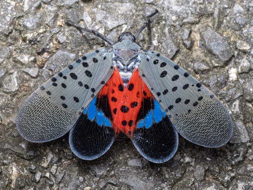
You might spot Spotted Lanternfly and Northern Cardinal.
View guide →


.jpg&width=800)