


Carpenter Ant

Buchanan State Forest offers stunning landscapes, diverse recreation, and rich history in southcentral Pennsylvania.
Buchanan State Forest offers stunning landscapes, diverse recreation, and rich history in southcentral Pennsylvania. Spanning an impressive 72,286 acres across Franklin, Fulton, and Bedford counties, this vast state forest is a vital part of the Ridge-and-Valley Appalachians, showcasing rugged mountains, deep valleys, and verdant woodlands primarily composed of mixed oak, with pockets of pine, hemlock, and red maple flourishing in cooler ravines. Named in honor of James Buchanan, the 15th U.S. President and a Franklin County native, the forest provides a unique blend of natural beauty and historical intrigue, inviting visitors to explore its expansive and often remote wilderness.
Among its most captivating features are over 200 miles of hiking trails, including sections of the formidable Mid State Trail, Tuscarora Trail, and Standing Stone Trail, catering to all levels of outdoor enthusiasts. A truly distinctive highlight is the Abandoned Pennsylvania Turnpike, also known as the Pike2Bike Trail, an 8.5-mile stretch of deserted highway with eerie, graffiti-adorned tunnels like the mile-long Sideling Hill Tunnel, offering a post-apocalyptic experience for hikers and bikers. Visitors can also discover serene natural areas such as Sweet Root Natural Area, characterized by its majestic hemlocks, lush ferns, and a gushing mountain brook, or enjoy panoramic views from numerous scenic overlooks like Big Mountain Overlook and Warrior Ridge Vista.
Buchanan State Forest is an exceptional destination for those seeking a genuine outdoor adventure, blending challenging wilderness experiences with opportunities for historical discovery. Whether you're navigating the unique tunnels of the Abandoned Turnpike, searching for wildlife amidst mixed oak woodlands, or absorbing the breathtaking vistas from a mountain summit, the forest promises memorable moments. Its historical remnants, from segments of the old Forbes Road to Civilian Conservation Corps camps and the impressive South Penn Railroad Aqueduct, add layers of cultural significance to its natural splendor, making every visit an enriching journey through both nature and time. Turn your visit into a safari! Use the Snappit app to scan and log wildlife sightings here.
Buffs * Outdoor Adventurers (biking, ATV, snowmobiling) * Nature & Wildlife Photography * Families (with specific areas like picnic grounds and easier trails)
Hiking & Backpacking: Over 200 miles of trails, from easy paths to steep, rocky routes, including portions of the Mid State, Tuscarora, and Standing Stone Trails. Primitive backpack camping is allowed in most areas.
* **Biking: ** Utilize the extensive shared-use trail system, including the unique Abandoned Pennsylvania Turnpike.
* **ATV & Snowmobiling: ** Designated trails are available for summer ATV riding and winter snowmobiling in Fulton and Bedford counties.
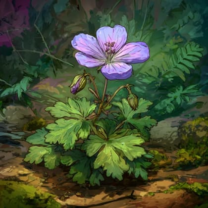
* **Wildlife Viewing: ** Opportunities to spot white-tailed deer, wild turkey, black bears, and various bird species like the Ruffed Grouse.
* **Picnicking: ** Enjoy well-maintained picnic areas like Bear Valley, Sideling Hill, Sweet Root, and Blankley, many with tables, pavilions, grills, and latrines.
* **Sightseeing: ** Drive or hike to numerous scenic overlooks throughout the forest.
* **Fishing & Hunting: ** Popular activities during designated seasons with appropriate licenses.
Campfires are restricted from March 1st through May 25th without authorization due to spring wildfire season. Be aware of hunting seasons, as hunting is permitted throughout most of the forest. Snow and ice can impact road and trail conditions in winter.
Some picnic areas are well-maintained with facilities like latrines. Certain vistas are accessible by car, and some trails are noted as "easily-accessible paths." A 1,357-acre tract in the Sideling Hill area is designated for off-road access by disabled hunters.
Explore 8.5 miles of deserted highway, including the unique Sideling Hill Tunnel and Rays Hill Tunnel, perfect for hiking and biking.
A popular and impressive vista offering panoramic views of the Ridge-and-Valley topography, especially stunning during fall foliage.
Discover this historic, mortarless stone aqueduct from the 1880s, accessible via the Railroad Arch Trail near Oregon Road.
Hike through this serene area featuring old-growth hemlocks, lush ferns, and a tranquil mountain brook.
Each card links to a full Explore page with photos, traits, and fun facts.
Start with the big picture, then zoom in to explore individual wildlife observations around this place.
Carry detailed maps
Cell service can be unreliable in parts of the forest. Download or carry physical maps of trails and roads, especially for longer hikes or remote areas.
Prepare for varying terrain
Trails range from easy to steep and rocky. Wear appropriate footwear and bring plenty of water, snacks, and first-aid supplies.
Check camping regulations
If planning to camp, understand the permit requirements for primitive and roadside sites, especially regarding campfires during spring wildfire season (March 1 - May 25).
Be aware of hunting seasons
Hunting is a popular activity, so wear blaze orange during hunting seasons for safety, particularly if venturing off marked trails.
Visit multiple scenic overlooks
Explore vistas like Big Mountain, Warrior Ridge, and Bark Road for different perspectives of the stunning Appalachian landscape.
Explore the Abandoned PA Turnpike
Don't miss this unique opportunity for hiking or biking through the historic tunnels; bring a flashlight or headlamp for the dark sections.
Jun 8, 2026
May 5, 2026
May 5, 2026
Apr 26, 2026
Apr 26, 2026

Maryland, US
You might spot White-Tailed Deer and Eastern Gray Squirrel.
View guide →
.jpg)
District of Columbia, US
You might spot Eastern Gray Squirrel, Duck, and House Sparrow.
View guide →

Illinois, US
You might spot American Robin, Canada Goose, and House Sparrow.
View guide →

Virginia, US
You might spot Spotted Lanternfly and Northern Cardinal.
View guide →


_(cropped).jpg&width=800)