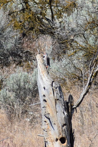


Red Tailed Hawk

Witness the raw power of ancient floods etched into the Washington landscape.
Witness the raw power of ancient floods etched into the Washington landscape. Drumheller Channels National Natural Landmark is a breathtaking testament to the cataclysmic Ice Age Missoula Floods, showcasing one of the most spectacular examples of "channeled scablands" on the Columbia Plateau. This extensively eroded landscape features hundreds of isolated, steep-sided basalt buttes surrounded by a labyrinthine network of usually dry channels, offering a dramatic glimpse into Earth's turbulent past. Designated for its outstanding geological significance, it's a place where the sheer force of water reshaped an entire region.
The landmark is a captivating outdoor museum, featuring unique geological formations such as towering basalt columns, deep "kolk" depressions carved by powerful water vortices, and vast, dry riverbeds that once channeled unimaginable volumes of water. Visitors can explore areas like the Crab Creek Unit, renowned for its basalt columns, or hike the McManamon Trail for panoramic vistas of the intricate scabland topography. As part of the Columbia National Wildlife Refuge, the area also supports a diverse ecosystem, providing sanctuary for over 200 species of mammals and birds, including numerous ducks, geese, and raptors like bald eagles.
A visit to Drumheller Channels is an unforgettable journey through geological time, offering profound insights into the planet's dynamic history. It's an inspiring destination for nature lovers, photographers, and anyone seeking to connect with the immense forces that shaped our world. The stark beauty and scale of the landscape leave a lasting impression, revealing the awe-inspiring story of the Ice Age floods. Turn your visit into a safari! Use the Snappit app to scan and log wildlife sightings here.
The Drumheller Channels are a product of the late Pleistocene Glacial Missoula Floods, a series of catastrophic events where an ice-dammed Glacial Lake Missoula repeatedly burst, sending torrents of water across the Columbia Plateau. These floods, occurring at a scale unparalleled in geological or historical records, violently scoured away topsoil and underlying basalt, carving the complex network of channels, buttes, and basins visible today. Geologist J Harlen Bretz pioneered the understanding of these monumental floods in the early 20th century, though his theories initially faced skepticism. The name "Drumheller" is believed to be derived from a farming family who provided hospitality to Bretz and his students in 1922, or possibly an early Spokane mayor. In recognition of its extraordinary illustrative value and geological significance, the Drumheller Channels were designated a National Natural Landmark by the U.S. National Park Service in 1986.
Engage in hiking and photography to capture the unique geological formations. Birdwatching is excellent due to the overlap with Columbia National Wildlife Refuge, offering chances to see numerous waterfowl and raptors. Interpretive trails provide insights into the area's formation.
Spring brings a flush of wildflowers across the landscape. Summer heat can be extreme, making early morning or late afternoon visits preferable. Winter can be cold and potentially snowy, limiting access to some unpaved areas.
Access primarily involves gravel roads and hiking trails. While specific accessibility information is limited, the Pipistrelle Cliffs Trail follows a service road, offering a relatively easier path to view geological features. Visitors should be prepared for uneven terrain on most trails.
The vast, dry channeled scablands, towering basalt columns (such as "Nick's Columns"), deep "kolk" depressions, and panoramic viewpoints are central to the experience. Don't miss the McManamon Trail for expansive views.
Each card links to a full Explore page with photos, traits, and fun facts.
Start with the big picture, then zoom in to explore individual wildlife observations around this place.
Wear sturdy footwear
Trails can be rocky, uneven, and unpaved; appropriate hiking shoes are essential.
Bring plenty of water
The area is exposed, and summer temperatures can be very high, making hydration crucial.
Visit in spring for wildflowers
Late spring (e.g., early June) often brings wildflowers to the landscape, adding color to the dramatic scenery.
Be aware of wildlife
The area is home to rattlesnakes, especially in warmer months, so watch your step and keep a respectful distance from all wildlife.
Utilize viewpoints
Stop at designated overlooks, such as the official viewpoint off West McManamon Road, to grasp the immense scale and complexity of the channels.
Consult the Ice Age Floods Institute
This organization provides valuable resources, maps, and trail descriptions to enhance your visit.
May 22, 2026
Photo attribution
no rights reserved
License: CC0 1.0 ↗
Image may be shown cropped inside the card frame.
May 22, 2026
Photo attribution
no rights reserved
License: CC0 1.0 ↗
Image may be shown cropped inside the card frame.
May 22, 2026
Photo attribution
no rights reserved
License: CC0 1.0 ↗
Image may be shown cropped inside the card frame.
May 22, 2026
Photo attribution
no rights reserved
License: CC0 1.0 ↗
Image may be shown cropped inside the card frame.
May 3, 2026

Maryland, US
You might spot White-Tailed Deer and Eastern Gray Squirrel.
View guide →
.jpg)
District of Columbia, US
You might spot Eastern Gray Squirrel, Duck, and House Sparrow.
View guide →

Illinois, US
You might spot American Robin, Canada Goose, and House Sparrow.
View guide →
Virginia, US
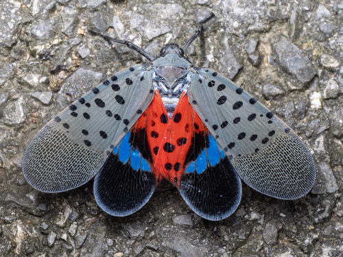
You might spot Spotted Lanternfly and Northern Cardinal.
View guide →