


Douglas Fir

Perched atop Salt Spring Island, Mount Maxwell Provincial Park offers an unparalleled escape into nature, boasting some of the most breathtaking panoramic views in the Gulf Islands.
Perched atop Salt Spring Island, Mount Maxwell Provincial Park offers an unparalleled escape into nature, boasting some of the most breathtaking panoramic views in the Gulf Islands. From its highest point, Baynes Peak, visitors are treated to expansive vistas of Vancouver Island, the surrounding Gulf Islands, and the distant British Columbia mainland, a sight that truly captures the essence of the Pacific Northwest. Established for its distinctive landmark and scenic beauty, this day-use park provides a serene setting for those seeking both adventure and tranquility amidst diverse natural landscapes.
The park is a haven for diverse ecosystems, featuring majestic stands of old-growth Douglas-fir and the picturesque Garry oak meadows, which are critical habitats for a variety of plant and animal species. Visitors exploring the 6 km of maintained trails can encounter a rich array of flora, including the vibrant purple foxglove, delicate Fairy-slipper, and the iconic Pacific madrone, alongside abundant western sword fern and Ocean spray. Keep an eye out for wildlife such as Mule Deer browsing in the undergrowth or the soaring silhouettes of Turkey Vultures overhead, making every turn a potential discovery. The park also provides a home to smaller creatures like the Pacific chorus frog, Northwestern Garter Snake, and a variety of native bees and bumble bees.
Mount Maxwell Provincial Park is more than just a viewpoint; it's an immersive natural experience that lingers in your memory long after your visit. Whether you're capturing the dramatic cliff-edge photos, enjoying a picnic with a spectacular backdrop, or simply reveling in the peace of the old-growth forest, the park offers a profound connection to nature. Its unique combination of stunning landscapes, rich biodiversity, and accessible trails makes it a must-visit destination for anyone exploring Salt Spring Island, promising moments of awe and discovery. Be ready to snap and learn! Get the Snappit app to identify any nature species you find here.
Mount Maxwell Provincial Park was originally established in 1938 for its distinctive viewing point. The mountain itself was initially named Mount Baynes around 1859 by Captain Richards during his British Admiralty surveys. However, local residents began referring to it as Mount Maxwell, after the Maxwell family who resided in the Burgoyne Valley and owned property that included the mountain. The name "Mount Maxwell" was officially adopted on May 2, 1911, while the highest point retained the name Baynes Peak. The park holds significant cultural importance for the Cowichan First Nation, who know it as Hwmat'etsum, or "bent over place," featuring in their origin stories. Archaeological sites of spiritual significance, including 3,000-year-old settlements marked by extensive middens, are found below the adjacent Mount Maxwell Ecological Reserve, indicating a long history of First Nation presence and activity in the area. The park was expanded in 2004 to its current size of 231 hectares, and along with the Mount Maxwell Ecological Reserve and Burgoyne Bay Park, it forms a vast protected area of over 1100 hectares, preserving crucial Garry oak meadows and other diverse habitats.
Hiking: Approximately 6 km of maintained trails ranging from easy strolls to more demanding hikes. Trails lead through wooded areas and along the ridge.
Picnicking: Day-use picnic areas are available at the summit with stunning views.
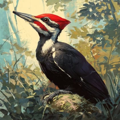
Wildlife Viewing: Observe local species such as Mule Deer, various birds like Dark-eyed Junco and American Robin, and the unique Propertius Duskywing butterfly.
Photography: Capture the iconic landscapes, unique flora, and diverse wildlife.
Spring: Wildflowers in bloom, active birdlife, moderate temperatures.
Summer: Warmest temperatures, best chance for clear views, can be popular. Road conditions are generally better.
Fall: Autumn colors, cooler temperatures, good for hiking.
Winter: Road to the summit can be rough, muddy, and potentially challenging; 4x4 vehicles with high clearance are highly recommended or required due to surface erosion, deep potholes, and exposed bedrock. Pit toilet may be closed.
The main viewing areas at the summit are generally accessible from the parking lot via short, easy paths, but the road leading to the park is very rough and narrow. While there's a picnic area and pit toilet (though currently closed due to road conditions), visitors should be aware that the overall accessibility is limited by the challenging access road. Some viewpoints are protected by chain-link fencing.
The highest point on Salt Spring Island, offering spectacular panoramic views of Vancouver Island, the Gulf Islands, and the mainland.
Old-growth Douglas-fir forests and Garry oak meadows.
Wildlife viewing opportunities, including raptors like Turkey Vultures.
Each card links to a full Explore page with photos, traits, and fun facts.
Start with the big picture, then zoom in to explore individual wildlife observations around this place.
Vehicle Choice
If driving to the summit, use a 4x4 vehicle with high clearance, especially in wet conditions, due to the extremely rough and steep gravel road.
Stay on Trails
Always stay on designated trails, particularly near cliff edges, for your safety and to protect delicate ecosystems.
Pack Essentials
Bring plenty of water, snacks, appropriate footwear for hiking, and a camera to capture the stunning views and wildlife. Potable water is not available.
Leash Pets
If bringing pets, ensure they are on a leash at all times and clean up after them.
Check Conditions
Before visiting, check the BC Parks website for current advisories, especially regarding road conditions or facility closures (like the pit toilet).
Picnic with a View
Take advantage of the picnic tables at the summit for an unforgettable meal amidst breathtaking scenery.
Oct 4, 2025
Oct 4, 2025
Sep 28, 2025
Aug 1, 2025
Jul 27, 2025

Maryland, US
You might spot White-Tailed Deer and Eastern Gray Squirrel.
View guide →
.jpg)
District of Columbia, US
You might spot Eastern Gray Squirrel, Duck, and House Sparrow.
View guide →

Illinois, US
You might spot American Robin, Canada Goose, and House Sparrow.
View guide →
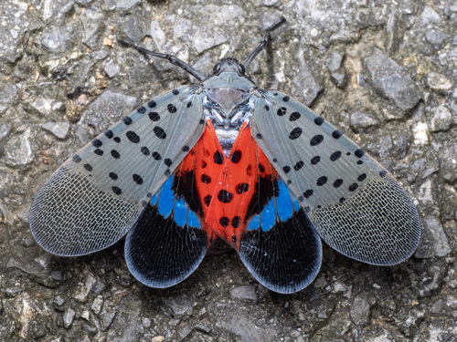
Virginia, US
You might spot Spotted Lanternfly and Northern Cardinal.
View guide →