


Eastern White Pine
The Shenipsit Trail offers a quintessential Connecticut hiking adventure, winding through diverse landscapes and offering stunning vistas.
The Shenipsit Trail offers a quintessential Connecticut hiking adventure, winding through diverse landscapes and offering stunning vistas. This 50-mile, Blue-Blazed hiking trail stretches across central Connecticut, inviting exploration from its southern terminus in Cobalt to near the Massachusetts border in Stafford. It traverses rocky, hilly, and forested terrain, connecting several state forests and municipal parks, making it a beloved destination for outdoor enthusiasts.
As hikers journey along the Shenipsit Trail, they encounter a rich tapestry of New England woodland. The trail is characterized by mature forests predominantly featuring **Northern Red Oak**, **Red Maple**, **Eastern Hemlock**, and towering **Eastern White Pine**, providing a vibrant display of colors, especially during autumn. Keep an eye out for abundant wildlife such as **White-tailed Deer** gracefully moving through the underbrush, energetic **Eastern Gray Squirrels** scampering up trees, and a variety of **songbirds** filling the air with their melodies. Specific highlights include the expansive views from Great Hill and Case Mountain, offering panoramas of the Connecticut River Valley and even the Hartford skyline.
Whether you seek solitude, a challenging long-distance trek, or a peaceful day hike amidst nature, the Shenipsit Trail delivers. Its varied sections provide opportunities for birdwatching along the tranquil Tankerhoosen River, where **Great Blue Herons** might be spotted, or discovering the unique geological formations and historical remnants like charcoal mounds that tell tales of the region's past. From the panoramic lookout tower on Soapstone Mountain to the quiet beauty of its forested paths, the Shenipsit Trail creates memorable experiences for every visitor. Unlock an interactive field guide for this spot: get the Snappit app to identify nature on the go.
buffs interested in early Connecticut forests and the CCC legacy
Hiking, trail running, nature photography, birdwatching for species like **Black-capped Chickadees** and **Blue Jays**, and wildlife spotting (e.g., **White-tailed Deer**, **Eastern Gray Squirrels**, **Wild Turkey**). During winter, some sections are suitable for snowshoeing and cross-country skiing.
Spring: Wildflowers bloom, **Spring Peepers** are vocal, and migratory birds return.
Summer: Lush greenery, longer days, but be aware of ticks and poison ivy.
Fall: Famous for vibrant **fall foliage** from **Red Maples** and **Northern Red Oaks**, and cooler hiking weather.
Winter: Tranquil, possibility of snow sports, less foliage to obscure distant views.
The Shenipsit Trail is primarily a rugged hiking path with rocky, hilly, and sometimes steep terrain, making most of it unsuitable for wheelchairs. Some sections, however, coincide with multi-use paths like the Hop River Bike Path, which may offer more accessible stretches.
Offers sweeping views of the Connecticut River and Great Hill Pond.
Provides excellent views of the Hartford skyline.
A reconstructed fire tower delivering panoramic vistas of the Connecticut River Valley, the Springfield skyline, Mount Greylock in Massachusetts, and Mount Monadnock in New Hampshire.
Scenic areas, particularly within the Belding and Tankerhoosen Wildlife Management Areas, ideal for spotting waterfowl and **Great Blue Herons**.
Each card links to a full Explore page with photos, traits, and fun facts.
Start with the big picture, then zoom in to explore individual wildlife observations around this place.
Wear appropriate footwear
Sturdy hiking boots are recommended due to the rocky and varied terrain.
Bring a map
While blue blazes mark the trail, carrying a physical map or having an offline digital map is advisable, as GPS signals can be spotty and marked trails can be intertwined with unmarked ones, especially in state forest sections.
Tick and poison ivy awareness
Be vigilant about checking for ticks, especially during warmer months, and learn to identify and avoid poison ivy, which is present along the trail.
Stay hydrated and carry snacks
Depending on the length of your hike, ensure you have sufficient water and energy-boosting snacks.
Practice Leave No Trace
Carry out all trash and leave the natural environment as you found it.
Be aware of hunting seasons
Portions of the trail pass through state forests where hunting is permitted. During hunting seasons, wear bright colors for visibility.
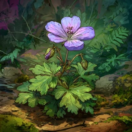
Jun 15, 2026
Photo attribution
(c) Bobby McCabe, some rights reserved (CC BY)
License: CC BY 4.0 ↗
Image may be shown cropped inside the card frame.
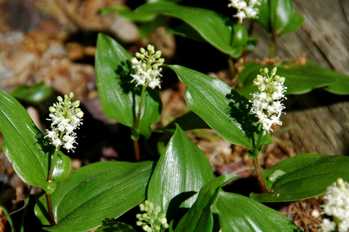
May 31, 2026
Photo attribution
(c) Bobby McCabe, some rights reserved (CC BY)
License: CC BY 4.0 ↗
Image may be shown cropped inside the card frame.
Jun 16, 2026
Jun 15, 2026
Jun 9, 2026

Maryland, US
You might spot White-Tailed Deer and Eastern Gray Squirrel.
View guide →
.jpg)
District of Columbia, US
You might spot Eastern Gray Squirrel, Duck, and House Sparrow.
View guide →

Illinois, US
You might spot American Robin, Canada Goose, and House Sparrow.
View guide →
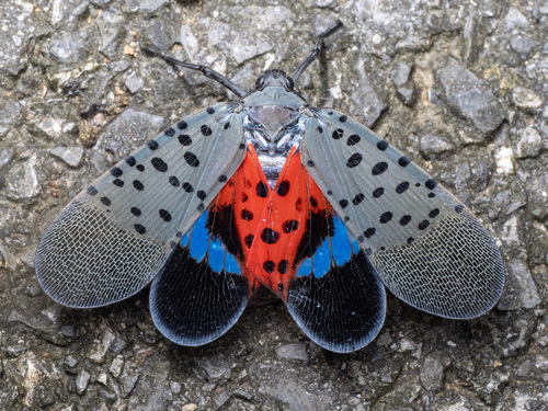
Virginia, US
You might spot Spotted Lanternfly and Northern Cardinal.
View guide →